The Ultimate South Carolina Waterfalls Road Trip
The Camping Kiddos at Station Cove Falls near Walhalla, South Carolina
This South Carolina waterfalls road trip itinerary takes you through 4 beautiful counties in the Upstate as you explore incredible natural features of all shapes and sizes.
You’ll visit some of our favorite state parks, hike along streams, and discover a few hidden waterfalls, too!
I spent several years of my childhood in this part of South Carolina and then returned to it for college. My in-laws also live here, so we’ve spent many wonderful days hiking around this area.
I’m sharing all of my insider knowledge in this huge South Carolina waterfall guide in the hopes that you’ll hit one of these trails with your family soon.
Below, you’ll find everything you need to know to plan the ultimate day out waterfall chasing, including how difficult each trail is, the location of the falls, and other tips.
I’ve also included a map of these South Carolina waterfalls so your entire road trip is easy to plan and follow.
This post contains affiliates. If you purchase through the links below, I will receive a commission at no charge to you.
SC Waterfalls Road Trip Map
SC Waterfalls Road Trip, Stop-by-Stop
Waterfall trails and road trips are two of my favorite things, so you can imagine how I feel about this itinerary.
I’ve included only waterfalls that can be accessed on foot on public property and trails. There are many more waterfalls in this area that are on private property, but I can’t condone trespassing just to get to a waterfall.
If you’re feeling extra adventurous, you can kayak or boat to a couple of the falls below. While I haven’t included all of the standard information, I have still noted where these falls are located on the road trip if you want somewhere to kayak or canoe.
Where possible, I’ve also included trail information, recommended places to camp, and anything else I thought would be helpful for you and your family.
Start: Greenville, South Carolina
We are starting our waterfall road trip in downtown Greenville, which is one of the fastest growing areas in South Carolina. Downtown Greenville is a bit of a revitalization star student as this downtown went from uninspired and unloved to thriving in less than 20 years.
At the heart of the downtown Greenville revitalization is Falls Park on the Reedy, where you can easily access Reedy River Falls.
Reedy River Falls: Quick Facts
Rating: Easy
Total distance: 0.25 miles
Type of trail: walk-up in park
Registration required: no
Walk down through the grassy lawn of the park, or see the falls from above on Liberty Bridge.
If you’re hungry, Smoke on the Water restaurant is less than a block from the falls and serves up incredible salads.
For a longer hike, visit the falls, then head south out of the park to access the Swamp Rabbit Trail on Furman College Way.
If you have time, I’d encourage you to linger in Greenville for a day or two as there is so much to enjoy about this area.
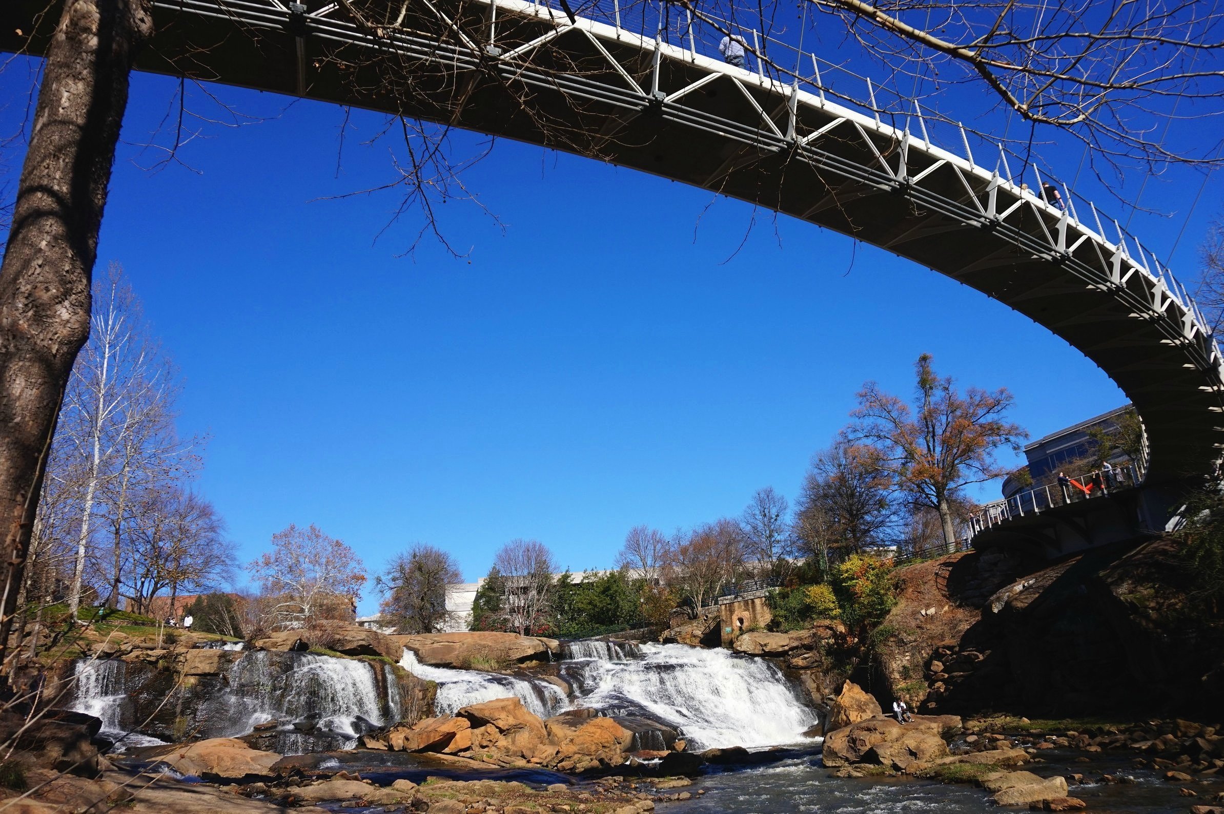
Reedy River Falls in Falls Park, downtown Greenville
Stop 1: Jones Gap State Park
After you’ve had your fill of the city, it’s time to head to one of South Carolina’s prettiest state parks, where you’ll be able to take your first couple of real waterfall hikes.
While there are many hiking trails here, you’re going to want to focus on the 2 that offer up significant waterfalls.
First of all, Jones Gap Falls is the park’s namesake, and it’s well worth your time.
From the park’s headquarters, pick up the Jones Gap Trail by going left on the service road and crossing a small bridge to the trailhead.
Jones Gap Falls: Quick Facts
Rating: moderate
Total distance: 3.5 miles
Type of trail: out-and-back
Registration required: yes
You’ll stay on this trail for about half a mile, when you’ll see the turnoff for Rainbow Falls (more on that hike below). Keep on Jones Gap Trail for another half-mile or so, when you should see the sign for Jones Gap Falls.
To access the falls, turn right at this sign. You’ll quickly see the falls.
The falls aren’t huge, but they are pretty. There’s no swimming hole here, though you can easily access some of Cox Camp Creek below the falls.
You won’t have to look far for your next waterfall as Rainbow Falls is also accessible off of Jones Gap Trail.
From Jones Gap Falls, return to Jones Gap Trail, and turn to your left, heading back towards the visitors center and park office.
Rainbow Falls: Quick Facts
Rating: moderate
Total distance: 4.6 miles
Type of trail: out-and-back
Registration required: yes
You’ll find the Rainbow Falls turn-off from the Jones Gap Trail about halfway between the Jones Gap Falls spur and the visitors center.
The Rainbow Falls spur does have a fairly continuous incline on the way to the falls, so be prepared for that.
The waterfall itself is worth the trouble, though.
The trail takes you to the base of the falls, so you can see the Upper Falls up close. The less impressive Lower Falls is right below. There’s no swimming area here, but you’ll get a quick spray of water as you get close to the falls.
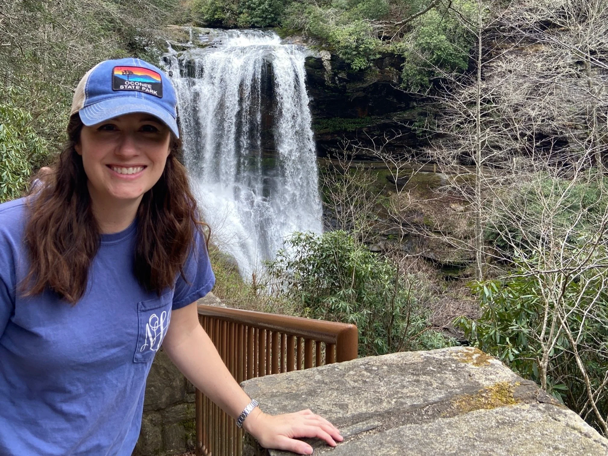
NOTE: You can also access Rainbow Falls from the YMCA Camp Greenville campus (which is how I first saw this waterfall when I was 11!), but it’s private property.
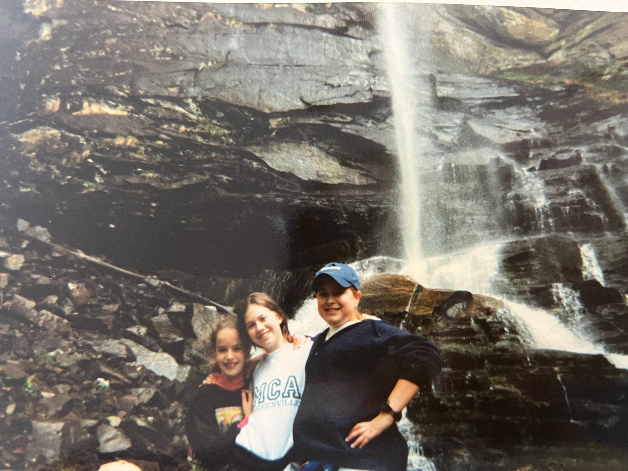
A major throwback of 5th grade Natalie (I’m the one in the middle) and two of my friends while we were visiting Rainbow Falls at camp
There’s one more waterfall you should explore in this area before you move onto the next stop: Wildcat Branch Falls.
Wildcat Branch Falls is on the southern end of Jones Gap State Park just outside of the park’s border.
Wildcat Branch Falls: Quick Facts
Rating: easy
Total distance: negligible for lower falls; 1 mile nature trail to upper falls
Type of trail: out-and-back
Registration required: no
From the Jones Gap State Park visitors center, head out of the park on River Falls Road, then turn right onto Highway 276.
Wildcat Branch Falls will be on the left side of the road about 3.2 miles from that intersection. Park at the Wildcat Wayside Park, where you’ll be able to see and hear the lower falls almost immediately. On a hot day, you can jump in the pool at the base of the falls.
If you’d like to see the upper falls as well, you can hop onto the nature trail to the left of the lower falls. The upper falls are 1 mile on the out-and-back trail, but, honestly, the lower falls are a lot more impressive.
NOTE: You can do Caesars Head State Park and Wildcat Falls on a private tour from Greenville if you only have time for one day’s adventures.
Stop 3: Caesars Head State Park
Silver Steps Falls: Quick Facts
Rating: easy
Total distance: 1 mile
Type of trail: out-and-back
Registration required: no
Interestingly, Jones Gap State Park joins up with Caesar Head State Park to create the Mountain Bridge Wilderness Area, which is packed with hiking opportunities.
On the other end of the Mountain Bridge Wilderness Area, but still on the Jones Gap Trail is the small but picturesque Silver Steps Falls.
Also known as Dargan’s Cascade, you can access this waterfall from Jones Gap State Park on the Jones Gap Trail or from the Silver Steps Falls Trail off of Highway 276.
If you’re hiking on the Jones Gap Trail, Silver Steps Falls is roughly 3 miles past the turn-off to Jones Gap Falls.
If you’re hiking in on the Silver Steps Falls, the cascade is just before the white-blazed Silver Steps Falls Trail intersects with the blue-blazed Jones Gaps Trail (about 1 mile).
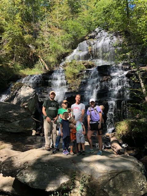
Raven Cliff Falls is one of the tallest waterfalls in the state, plunging 400 feet over a cliff.
Located inside Caesars Head State Park, this waterfall is at the end of 4 mile out-and-back trail.
Raven Cliff Falls: Quick Facts
Rating: moderate
Total distance: 4 miles
Type of trail: out-and-back
Registration required: no
While the trail is largely flat and easy, the distance does push this into the moderate category for my family. There is a slight elevation loss towards the beginning of the trail (so you’re hiking uphill the last quarter-mile to your car), and there are stairs on the observation tower.
While you can’t get close to the base of the falls on this hike, you will be treated to spectacular views from the observation tower at the end of the trail.

PIN ME!
See if you can spot the trail’s namesake birds in this area—there are more than 150 species of ravens that have been identified here!
The parking area off of Highway 276 in the park is well marked as is this entire red-blazed trail.
If you have time to linger near Caesar’s Head State Park, I would. In addition to the waterfall hikes above, the area has several other of the best hikes near Greenville, including the kid-friendly Frank Coggins loop trail.
Stop 4: Rocky Bottom, South Carolina
Rocky Bottom is a tiny, unincorporated area in Upstate South Carolina, but it has a couple of interesting waterfalls.
You’ll see the parking area and trailhead for Beech Bottom Falls off of F. Van Clayton Memorial Highway (also known as Sassafras Mountain Road).
NOTE: If you continue on Sassafras Mountain Road, there’s a great overlook at the highest point in South Carolina!
Beech Bottom Falls: Quick Facts
Rating: moderate
Total distance: 1.7 miles
Type of trail: out-and-back
Registration required: no
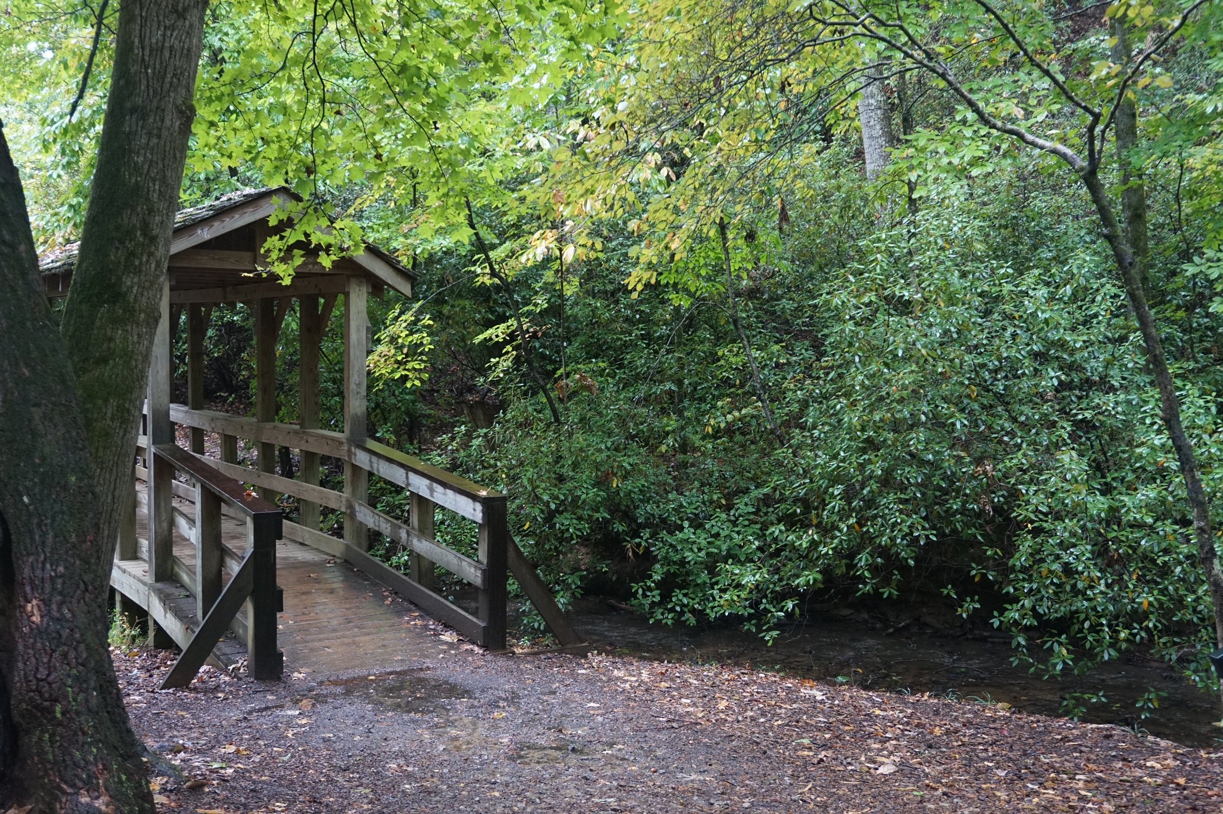
Beech Bottom Falls trail crosses Abner Creek a couple of times on the way to the fall. My kids love a foot bridge on hikes, and there are a couple rustic-style ones here.
Overall, the trail is easy enough for my kids and other younger hikers to handle, though there are a few sections of dirt and wood stairs along the way.
The falls are located in a section where the banks are very steep, so you’ll need to use the wooden observation tower to safely see them. Stay on the path and at the tower as it would be unwise to try and get closer to the falls.
Another note: in the last decade, the waterfall’s name has changed inexplicably from Pinnacle Falls to Beech Bottom Falls, so if you see older literature calling it another name, that’s why.
Our next waterfall on the road trip isn’t far. From the Beech Bottom Falls parking lot, take Sassafras Mountain Road west, then take a right at the intersection of Pickens Highway.
Eastatoe Narrows: Quick Facts
Rating: moderate
Total distance: 3.4 miles
Type of trail: out-and-back
Registration required: no
In 0.8 miles, look for the left turn onto Laurel Valley Road, and then an immediate right onto Horse Pasture Road. After 0.4 miles, you’ll see the trailhead for the Eastatoe Gorge Spur Trail.
The Eastatoe Narrows is so named for the squeeze that the Eastatoe Creek does as it enters the gorge. The trail is generally easy, though the descent closer to the falls is fairly steep, and kids may require some additional help.
Because of the landscape, you won’t be able to get super close to the waterfall as the trail crosses over the falls rather than near it.
For more information, check out this detailed Eastatoe Narrows trail guide.

Virginia Hawkins Falls in the summer
Getting to Virginia Hawkins Falls is just as much of an adventure as the actual trail.
Virginia Hawkins Falls: Quick Facts
Rating: difficult
Total distance: 3.4 miles
Type of trail: out-and-back
Registration required: no
From the Eastatoe Gorge Spur Trailhead, you’ll continue going down Horse Pasture Road for about 3 miles. There is a small gravel parking area at the Laurel Fork Gap trailhead.
I’d suggest taking an SUV, Jeep, or truck, preferably with 4-wheel drive as the road has ruts and can be very uneven, particularly after it rains.
From that trailhead, you’ll follow an old logging road until you see the clearly marked wooden sign for Virginia Hawkins Falls. (There’s also a backcountry, hike-in primitive campground here if you’d like to extend your stay!)
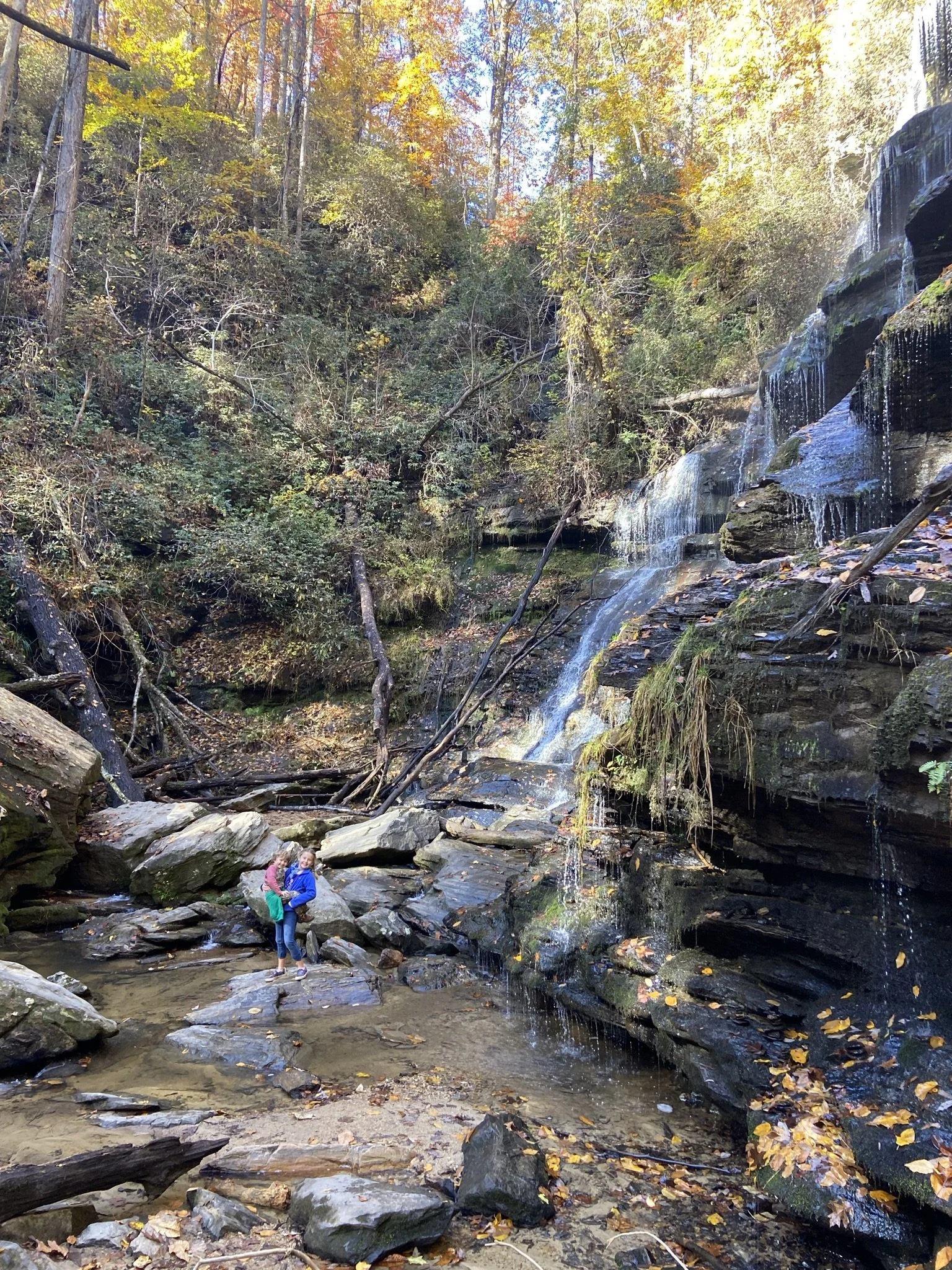
At only 25’ tall, the Virginia Hawkins Falls isn’t huge, but it’s quite pretty with multiple small cascades.
NOTE: This waterfall was known as Double Drop Falls up until around 2004.
If you were to continue onto the Foothills Trail and NOT take the turn-off to Virginia Hawkins Falls, you’d come to Laurel Fork Falls at the end of this trail.
Laurel Fork Falls: Quick Facts
Rating: difficult
Total distance: 7.1 miles
Type of trail: out-and-back
Registration required: no
Laurel Fork Falls has one of the longest trails on this list, and getting to the falls requires 7.1 mile out-and-back hike starting from the Laurel Fork Gap trailhead.
While you can hear the falls (and see smaller cascades) from the designated trail, it’s hard to get a complete glimpse of Laurel Fork Falls unless you’re viewing it from Lake Jocassee. This is one of those waterfalls that is also accessible by boat.
This is a long hike, so you might want to stay at the primitive camping area about 0.5 miles from the waterfall on the Foothills Trail.

Laurel Fork Falls from the base | source
If you’re looking for something else to do in this area, take your car from the trailhead parking lot back onto Horse Pasture Road for another 6.5 miles to Jumping-off Rock. While you shouldn’t literally jump off anything here, as you’re on the side of a mountain, you’ll be treated to immense long range views of Sassafras Mountain, Lake Jocassee, and the entire area.
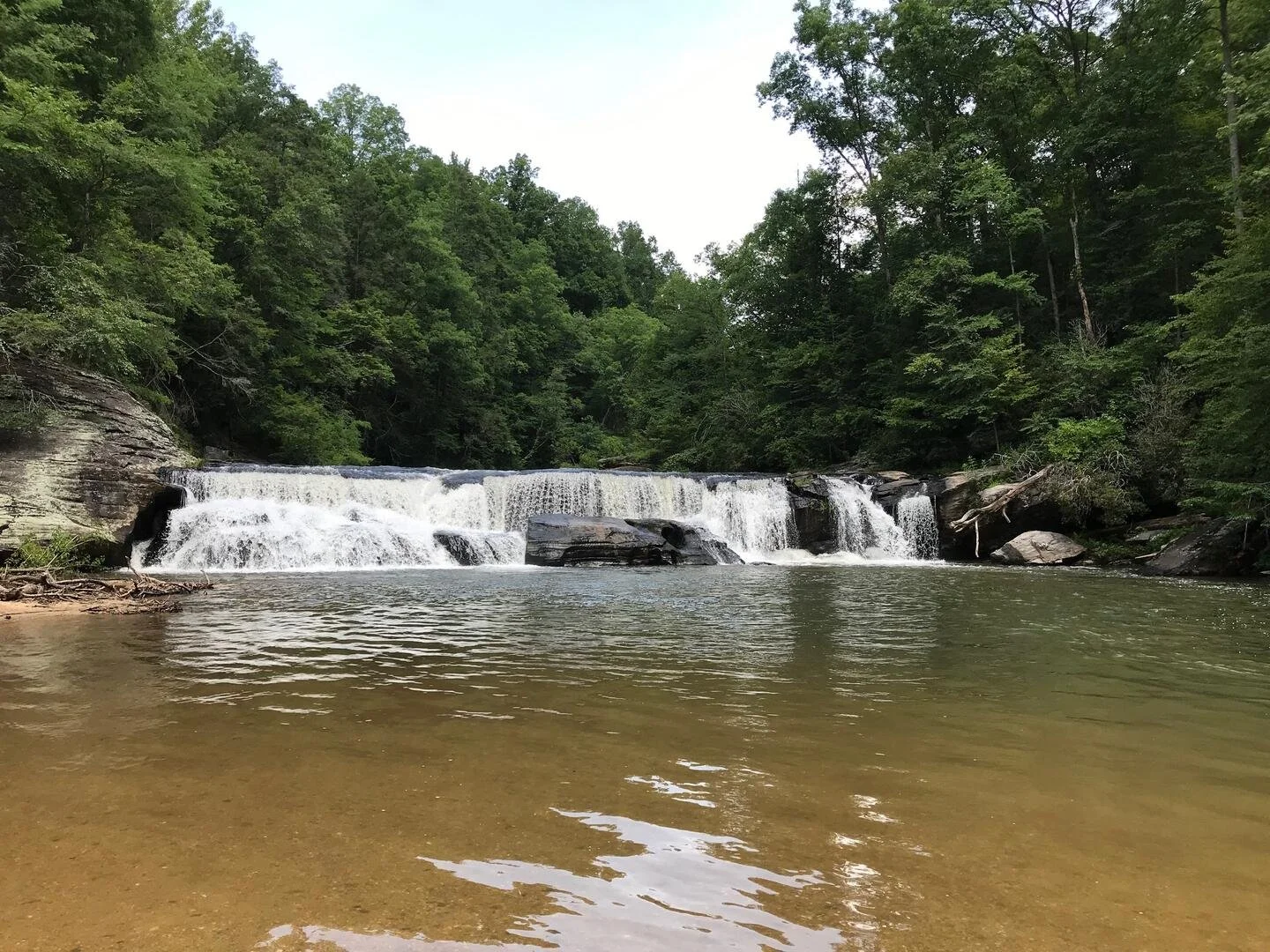
South of Rocky Bottom is the Twin Falls Trail, located off of the aptly named Waterfalls Road. You’ll find the parking area for this trail at the end of the road.
Twin Falls Trail: Quick Facts
Rating: easy
Total distance: 0.3-1.3 miles, depending on the route
Type of trail: out-and-back
Registration required: no
NOTE: This waterfall set is known by 2 other names: Eastatoe Falls or Reedy Cove Falls.
This waterfall is an anomaly on this list as it’s actually a double waterfall! The river splits just before it goes over the cliff, so you’ll see twin cascades just a few feet apart.
To get to the falls, you have an easier hike to the base of the 2 falls, which I recommend for families with little kids. This trail allows you to have a beautiful view of the double cascade without much risk.
The other hike (the upper hike) is longer at 1.3 miles and end directly at the top of the falls. It should go without saying, but this location is highly dangerous and you shouldn’t get into or near the water for fear you’ll go over the edge.
If you’d like to get into the water along either trail, there are swimming holes on the lower hike that would be appropriate for kids.
Find directions for each of the Twin Falls trail options here.
NOTE: Devil’s Hole Creek Falls is also in this area, but is only accessible by boat from Lake Jocassee.
Stop 5: Western Lake Jocassee
Let’s head around Lake Jocassee to the western side.
Wright Creek Falls and Mill Creek Falls are only accessible by boat. You can launch from nearby Devil’s Fork State Park, where rangers will also provide maps and directions to each.
Lower Whitewater Falls: Quick Facts
Rating: moderate
Total distance: 4.2 miles
Type of trail: out-and-back
Registration required: no
The view of Lower Whitewater Falls makes this relatively easy 4 mile roundtrip out-and-back trail a great day trip from Greenville, Clemson, or Walhalla.
The trailhead can be found on the Foothills Trail Access Road off of Bad Creek Road.
On the trail, you’ll pass over Whitewater River slightly before the halfway point between the parking lot and the waterfall.
While you’ll be able to catch glimpses of the falls towards the end of the trail, you’ll have the best views from the wooden observation tower. There’s no swimming area here.
If you’re wondering why I didn’t include Upper Whitewater Falls, it’s because it’s just above the North Carolina-South Carolina border!
Stop 6: Mountain Rest, South Carolina
The next cluster of waterfalls is located right in the corner of where South Carolina meets North Carolina and Georgia. These are all in the area north of Mountain Rest and to the west of Salem and Tamassee.
Spoonauger Falls: Quick Facts
Rating: easy
Total distance: 0.6 miles
Type of trail: out-and-back
Registration required: yes
Spoonauger Falls is known as Rock Cliff Falls, and the trailhead is located along Burrells Ford Road (FS 708) in Mountain Rest. From the trailhead and parking area, the falls are less than half a mile, making this one of the easier waterfall hikes in this area.
From the parking area, follow signs for the Chattooga River Trail, then turn right onto the spur for the waterfall. (This turn is well marked.)
There are a few switchbacks as you get close to the falls, which might be the most difficult part of this kid-friendly trail.
The paved trail ends with an observation area, or you can push onto the smaller dirt trail that will allow you to get to the base of the falls. Just note that there are several slippery areas on the way down to the falls if you choose to go all the way.
There’s no area that’s good for swimming here, but you can get right up to the base of the falls for some wading or a cool mist on a hot day.

Spoonauger Falls in winter | source
Another great waterfall off of Burrells Ford Road is King Creek Falls. The parking area for this waterfall is just 1/3 of a mile east from the parking area for Spoonauger Falls (above).
King Creek Falls: Quick Facts
Rating: easy
Total distance: 1.7 miles
Type of trail: out-and-back
Registration required: no
This out-and-back trail is a little less than 2 miles round trip and is an easy path with little elevation change.
Access the trail from the parking lot, and then go straight at the one fork in the Chatooga trail.
The only thing to watch out for is the large tree that has blocked the path—but part of the tree has been sawed away to allow people to scramble around it. Little kids will need help with this part, but they should be good elsewhere on the trail.
The waterfall itself is fairly large with a 70 foot cascade and a small pool of water perfect for splashing about in.
Combine King Creek Falls and and Spoonauger Falls for a full day of hiking in the Sumter National Forest.
You get 2 falls in 1 hike when visiting Pig Pen Falls and Licklog Falls.
Pig Pen and Licklog Falls: Quick Facts
Rating: moderate
Total distance: 4.1 miles
Type of trail: out-and-back
Registration required: no
These oddly named waterfalls are located on the same hiking trail, about 1/4 mile apart. Head to Nicholson Ford Road (FS775) and follow it for 2 miles. You’ll see a parking area on the right.
Look for a sign for the Foothills Trail. Follow the Foothills Trail for about 1/2 mile, then turn onto the Chattooga Trail. You’ll come to Pig Pen Falls first. It’s the smaller of the 2 waterfalls with a 25 foot cascade and a small swimming area.
Continue on the trail, crossing a foot bridge, and you’ll find Licklog Falls quickly. Licklog Falls has a couple of cascades, totaling around 80 feet.
Overall, this hike is great for kids as there’s little elevation change throughout the well-marked dirt trail.
Big Bend Falls’ Big Bend Trailhead is located near the Cherry Hill Recreation Area.
Big Bend Falls: Quick Facts
Rating: difficult
Total distance: 5.5 miles
Type of trail: out-and-back
Registration required: no
As you near the falls, there will be a trail intersection with the Chattooga Trail, and you’ll want to hang a left here.
The falls will be another 0.5 or so ahead. Big Bend Falls is on the dividing line between Georgia and South Carolina!
You can also access Big Bend Falls on the Chattooga Trail via a right-hand turn off near King Creek Falls. Simply stay on the Chattooga Trail until it intersects with the Big Bend Trail, and keep right at the intersection.
Cheohee Falls (also known as Miuka Falls) and Secret Falls are both accessible from the Cherry Hill Recreation Area, though across Highway 107 from the trailhead to Big Bend Falls.
Look for the Winding Stairs trailhead and follow this trail to Cheohee Falls, taking a right at the intersection you come to. Cheohee/Miuka Falls is down a small, well marked side trail on the left.
Cheohee/Miuka Falls: Quick Facts
Rating: easy
Total distance: 1.2 miles
Type of trail: out-and-back
Registration required: no
If you’re hiking with kids on this trail, keep in mind that there’s not a good place to get to the base of the falls without going down the banks of the river, and then standing on slippery rocks.
Secret Falls is just off trail further down the Winding Stairs Trail. For more information on how to locate this waterfall, see the directions here.
Continue north on Highway 107 to the Bee Cove Falls trailhead. This trail is fairly difficult as the remaining section requires hikers to find their own way down to the falls after the trail peters out.
For this reason, I’d suggest hiking this trail only if you’re an experienced hiker (and without young kids) as this is not the most accessible waterfall.
Bee Cove Falls: Quick Facts
Rating: difficult
Total distance: 4.2 miles
Type of trail: out-and-back
Registration required: no
Start your hike on FS 402, which is a gravel road off of Highway 107 to the right just after you pass Fish Hatchery Road on the left.
There will be three intersections on this trail; take a right at all of them. You’ll hear the falls before you see them, and this is where you’ll need to work your way down the bank to your right until you get to the base of the falls.
Lee Falls is another waterfall trail for the more experienced hiker as the trail really isn’t a trail, particularly in the beginning.
If you can get past that difficulty, you’ll follow Tamassee Creek on your way upriver to this beautiful 75-foot falls.
Lee Falls: Quick Facts
Rating: moderate
Total distance: 2.9 miles
Type of trail: out-and-back
Registration required: no
From the parking area on FS 175A, you’ll work your way across 3 different fields, where the path might be difficult to find or follow, depending on how many people have come through recently.
When you do find the path, it is a narrow trail that can be easily overlooked if you don’t know where you’re going.
From there, you’ll find an old forest road that winds through the trees. As you get closer to the falls, you’ll have to cross a couple of streams and then scramble over some large rocks and trees to get to the base of Lee Falls.
The majority of the hike is flat and kid-friendly, but the difficulty lies in finding the trail at the beginning and then picking your way to the base of the falls.
There are the remains of old stone tunnels in the rock gorge towards the falls, which is an interesting feature.
Stop 7: Oconee State Park
Located inside Oconee State Park, Hidden Falls is one of the area’s most popular waterfall hikes.
While it isn’t the biggest or most impressive waterfall on this list, Hidden Falls is a great hike for older kids and their families.
Hidden Falls: Quick Facts
Rating: moderate
Total distance: 5.1 miles
Type of trail: out-and-back
Registration required: yes
The trail is relatively easy if a bit long for beginning hikers, but the 60-foot cascade at the end of this trail is enough motivation for most.
Access to this trail is towards the back of the park. Follow State Park Road through the campground, past the playground, and beyond the first left-hand turn off to the cabins. You’ll see a parking lot on your left after the cabin turn-off; this is also the parking lot for the Tamassee Knob Trail.
Follow signs for the Foothills Trail from the parking lot, then look for the signage on the trail indicating the Hidden Falls turnoff around 1 mile into the hike.
If you’re staying the night in this area, I highly recommend camping in Oconee State Park!
We’ve stayed here both as tent and RV campers, and we find something new to love about it every time. From the lake with diving platform and canoe rentals to the weekly square dances, this state park’s activities are as close as you’re going to get to attending summer camp as a grown-up.
Stop 8: Oconee Station State Park
One of our favorite easy waterfall hikes on this list, Station Cove Falls is perfect for kids and first time hikers.
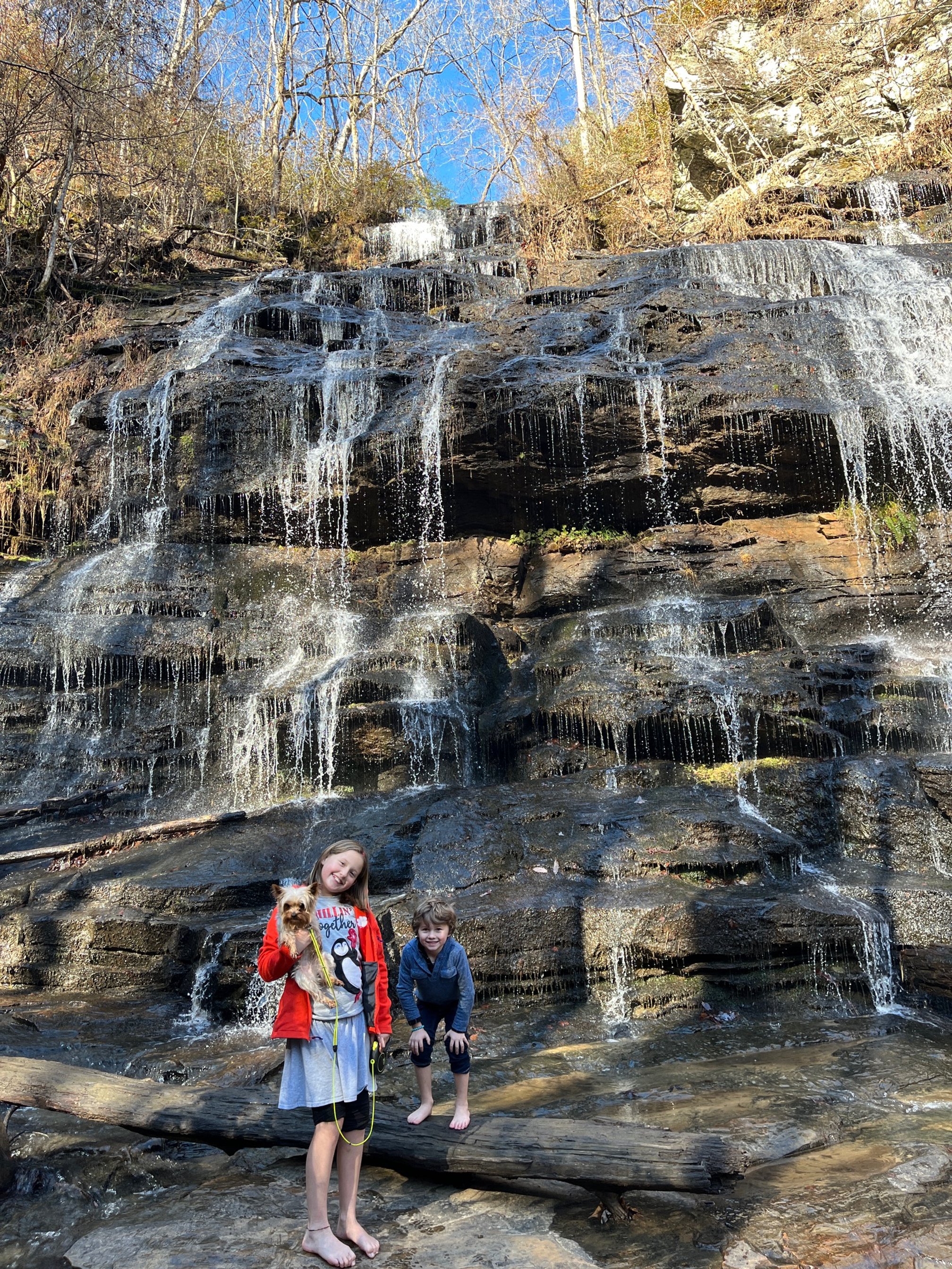
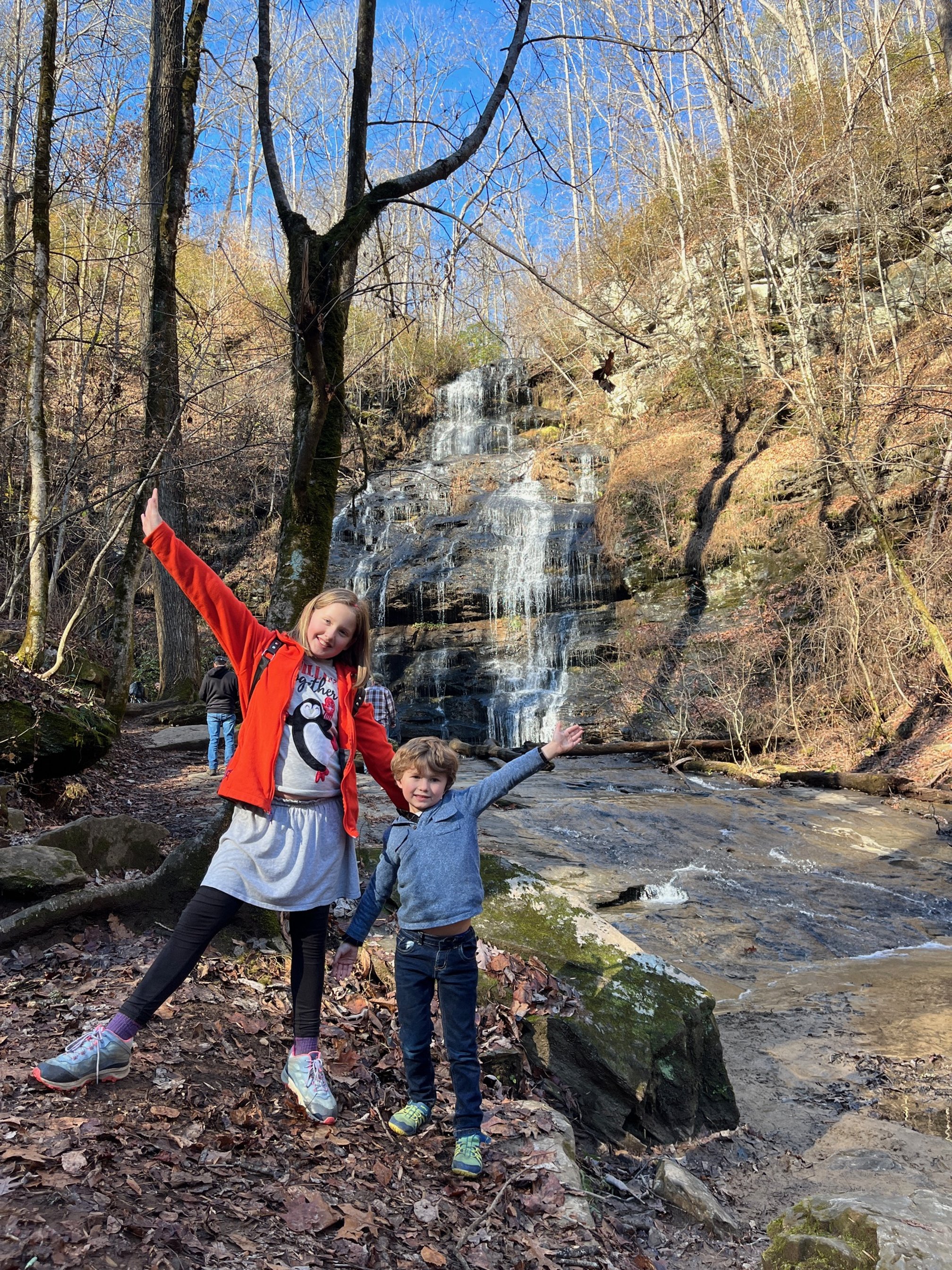
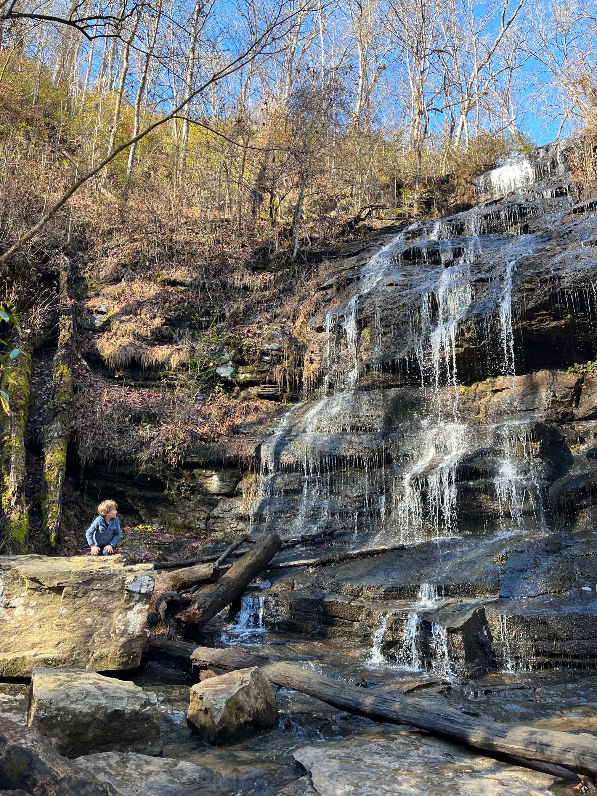
The trail is wide and easy to follow, and there are few areas of drastic elevation change. For the most part, the trail bobs up and down gently as you wander through a beautiful section of Upstate forest.
At the end of the trail, you’ll be treated to the beautiful Station Cove Falls. The trail leads right to the base of the falls, where kids can splash in the ankle-deep water or you can sit for a moment on one of the huge boulders.
Station Cove Falls: Quick Facts
Rating: easy
Total distance: 1.6 miles
Type of trail: out-and-back
Registration required: no
To get to the trailhead, drive onto Oconee State Road from Walhalla and continue past the entrance to the state park.
You’ll find a small parking area on your left with the trailhead information clearly posted.
Station Cove Falls is also accessible from Oconee State Park via the Oconee Passage of the Palmetto Trail.
Stop 9: Walhalla, South Carolina
Walhalla is one of our go-to hiking and camping areas in the Upstate as it is packed with incredible waterfalls and outdoor activities.
Issaqueena Falls: Quick Facts
Rating: easy
Total distance: 0.3 miles
Type of trail: out-and-back
Registration required: no
Issaqueena Falls is one of the area’s most popular waterfalls, thanks to the excellent infrastructure in this park. You’ll find a large parking lot, an easy hike to an observation deck, and picnic tables here. There are even vault toilets here.
Plus, you can easily access another of my favorite Wahalla destinations, the Civil War-era Stumphouse Tunnel, from this same parking lot.
Issaqueena Falls is super accessible for any visitor, with viewing options on that observation platform or from further down if you’d like to do some rock scrambling. The Stumphouse Passage of the Palmetto Trail picks up here, so you can follow the creek for several miles.
You can get close to the falls if your kids want to dip their feet into the water, though there’s no real swimming area here.
Just across Highway 28 from the entrance to Issaqueena Falls and Stumphouse tunnel is the turn-off for the Yellow Branch Falls trail parking lot.
This 3 mile out-and-back trail ends at the waterfall, which slowly trickles down a granite rock face.
It’s quite a popular hike, so come early to get a parking spot.
While we took our young kids on this hike—and they did fine—you should be aware that a couple of the sections of trail do have fairly steep drop-offs on one side.
There are also a couple of footbridges and some stream crossings to make things interesting.
Once you’re at the trail, there aren’t any true swimming areas, though the water at the base of the falls is shallow enough for some quick wading.
Back at the trailhead, you’ll find a couple of vault toilets and picnic tables if you’d like to make a day of it.
Yellow Branch Falls: Quick Facts
Rating: easy
Total distance: 3.0 miles
Type of trail: out-and-back
Registration required: no
The only trail on this list to beat the double-offering at Licklog Falls and Pig Pen Falls is the Fall Creek Falls trail, where you’ll see three different waterfalls along the way.
Fall Creek Falls: Quick Facts
Rating: moderate
Total distance: 2.6 miles
Type of trail: out-and-back
Registration required: no
NOTE: Fall Creek Falls Creek is currently closed as of 2024 as this area is reworked to accommodate a new passage of the Palmetto Trail.
However, getting to all but the first one requires careful navigation and possibly even bushwacking, so we’re suggesting this one for more experienced hikers.
Head to FS 722 (Fall Creek Road), where the parking area is just after a small bridge crossing Fall Creek.
The first of the three waterfalls, Andrew Ramey Falls, can be seen and heard from this parking area, but we’re not stopping there. Follow the faint (and sometimes none existent) trail along the river to get to the other 2 cascades on the trail.
The second cascade, Pristine Falls, is off on a small spur trail, and the final cascade at the end of the trail is Fall Creek Falls. For a full map of the trail and detailed trail information, see here.
Keep in mind that the trail can easily get overgrown during the spring and summer, so you’ll need to be an experienced hiker to safely navigate this area fully.
If you decide to head down to the base of any of the 3 cascades, use caution as the banks are quite steep in places—and slippery after a rain.
Grapevine Campground near Walhalla is a primitive campground that we’ve taken the kids to and had a lot of fun. (It was also my husband and his friends’ go-to camping spot while we were all at nearby Clemson University.)
Located at the end of FS 764, this campground is first come, first served with large lots, many of them by the Coppermine Branch of the Chauga River.
There aren’t any electrical outlets or drinking water, but there are shared vault toilets. We’ve seen both smaller travel trailers and Class B vans here, but the majority of visitors are tent camping.
If you’re looking for more things to do in Walhalla, SC, check out my entire guide to the area here.
Stop 10: Long Creek, South Carolina
Long Creek is another tiny community in Upstate South Carolina that’s a perfect base to explore some great waterfall hikes.
First, let’s head to Long Creek Falls. Get step-by-step instructions on finding the somewhat remote trailhead on Forest Service road 755 here.
The waterfall is nearly at the end of the trail: keep in mind that the trail does seem to peter out as you hear the waterfall, and you’ll have to take the smaller, less obvious trail down to the waterfall base. Get a great view of the nearby Chattooga River from the spur Top-of-the-Rock trail.
Long Creek Falls: Quick Facts
Rating: moderate
Total distance: 3.3. miles
Type of trail: out-and-back
Registration required: no
P.S. A part of the movie Deliverance was filmed here, but I wouldn’t worry too much about hearing any banjos here.
If you’d like to add on a second waterfall in this immediate area, check out Homer Falls, which is down to the left at the fork near the trailhead. I will note that the trail to Homer Falls is considerably trickier than that to Long Creek Falls, and you don’t want to go after it’s been rainy. The wet weather makes this already steep trail something slippery and dangerous.
Overall, Long Creek Falls is the best bet here, especially if you’re hiking with kids and/or beginning hikers.
The trailhead for Opossum Creek Falls is about half a mile back towards Battlecreek Road on Turkey Ridge Road, making this a great one to pair with Long Creek Falls.
Opossum Creek Falls: Quick Facts
Rating: moderate
Total distance: 4.4 miles
Type of trail: out-and-back
Registration required: no
For most of the hike, you’re walking along a well-marked, fairly wide old forest road, but things get more difficult about a half mile from the falls. The trail narrows significantly and requires rock scrambles and more technical navigation to get to the base of the fall.
Still, all but the smallest hikers should be able to handle it for a peek at this beautiful (and big!) waterfall.
There is a small beach here with some potential wading areas, but you’ll want to watch kids closely as the water moves swiftly.
Note that there’s about 800 feet of elevation change on this hike with most of it occurring near the trailhead. You’re hiking on a descent from the trailhead, so you’re on an incline as you head back to the car. Overall, it’s not bad, even if you’re not used to mountain hiking.
Head slightly north to the Georgia-North Carolina line via Long Creek Highway for our next stop.

Bull Sluice | source
Bull Sluice is a Class-5 rapid on the Chattooga River, and the trail to it is a section of the longer Chattooga Trail.
Bull Sluice: Quick Facts
Rating: easy
Total distance: 0.4 miles
Type of trail: out-and-back
Registration required: no
With only a 0.2 mile hike from the parking lot (0.4 miles round trip), this is one of the easiest access waterfalls on this list. However, there’s some debate on whether this is just rapids or it’s a small waterfall.
Regardless of the classification, temper your expectations. While it is an easy hike, this isn’t the most impressive water feature in the area.
However, it does have a small beach that is good for wading, and, if you’re trying to bag a few SC waterfalls, this is low hanging fruit.
The furthest south of the waterfalls on this stop of our road trip, Brasstown Falls is one of the most impressive in all of Oconee County.
Brasstown Falls: Quick Facts
Rating: easy
Total distance: 0.6 miles
Type of trail: out-and-back
Registration required: no
A trail renovation made this series of cascades much more accessible, thanks to the addition of foot bridges, clearer trail markings, and better trail infrastructure.
On this trail, you’ll be able to see all 3 cascades: Upper, Middle, and Lower Brasstown Falls.
It’s a kid-friendly trail with an excellent surprise at the end. The trail has a set of wooden stairs that lead down to a red sand beach and a calm wading pool.

Middle and Lower Brasstown Falls
NOTE: If you’re not from this area, the red dirt will stain everything you own, so don’t take any footwear or towels that 1) you can’t clean, and 2) are particularly fond of.
For such an easy trail, the waterfalls are a great pay-off, thanks to their size and the multiple cascades. You could easily spend an entire day here, splashing around and picnicking.
Blue Hole Falls is a lesser known waterfall in this area with a great little swimming hole at the base.
While the trail itself isn’t particularly difficult, you’ll want to check the weather before you start. This is in large part due to the fact that you’ll have to shuffle across Cedar Creek to get to the waterfall and swimming pool.
Blue Hole Falls: Quick Facts
Rating: easy
Total distance: 1 mile
Type of trail: out-and-back
Registration required: no
If it’s been raining recently, the stream may be too deep and swift to cross. If there’s any doubt, turn back and save this hike for another day.
If the water level is lower and the creek is calm enough to go across, you should be able to do so with a combination of stone hopping and wading in ankle-deep water.
The pay-off is worth the trouble on this rather forgotten trail as you’re likely to have the falls and pool to yourself. At most, you might have to share with just a couple of locals!
Learn more about Blue Hole Falls trail and trailhead directions here.
Stop 11: Westminster, South Carolina
Ramsey Falls: Quick Facts
Rating: easy
Total distance: 500 feet from parking area
Type of trail: none
Registration required: no
Possibly the most family friendly waterfall trail on this list, Ramsey Falls in Chau Ram County Park is easily accessible from a parking lot.
The waterfall itself isn’t huge, but there are some great opportunities for wading around. The park does offer tubing on the river which is an excellent way to cool off during the summer.
NOTE: The $2 entrance fee covers a full day at this county park. Take advantage of one of the many picnic areas and more than 4 miles of trails for a great family day out.
Riley Moore Falls is our favorite hidden swimming hole on this list!
Riley Moore Falls: Quick Facts
Rating: easy
Total distance: 1.9 miles
Type of trail: out-and-back
Registration required: no
Unless you have a 4x4, I’d suggest parking on Spy Rock Road as the Forest Road 478C is one-way and rugged. You’ll add about 0.5 miles to the overall trail by hiking down the forest road, but it’s an easy addition.
The trail itself starts at the tiny parking lot at the end of the forest road and slopes gently down to the Chauga River.
You’ll find a sandy beach here, perfect for snack breaks, and a wide swimming hole at the base of the falls.
Riley Moore Falls and swimming area
Stop 12: Central, South Carolina
We’ve arrived at our final stop on the South Carolina waterfall road trip!
Todd Creek Falls has a trailhead and parking off of Brookbend Road northeast of Central.
Todd Creek Falls: Quick Facts
Rating: easy
Total distance: 1.4 miles
Type of trail: out-and-back
Registration required: no
This easy trail passes over Todd Creek twice, and the waterfall overlook is between these 2 crossings.
It’s not a large waterfall, but it’s still worth your time.
To get to the base of the falls, you’ll have to take a small spur trail that will lead you to the swimming area and the best place to take a photo of the waterfall.
If you continue on the trail past the falls, there are some historic ruins from an old mill that are a good place to explore before turning back to your car.
The last waterfall on the road trip is Waldrop Stone Falls. The trailhead for it is about 20 minutes from Todd Creek, so you could easily add these together for a complete day’s hiking experience in Central.
Like Todd Creek Falls, Waldrop Stone Falls is an easy hike that’s great for all skill levels and families with kids.
Waldrop Stone Falls: Quick Facts
Rating: easy
Total distance: 0.8 miles
Type of trail: out-and-back
Registration required: no
The trail is mostly dirt, though there are some recently refurbished wooden stairs with rails to help hikers navigate the steepest sections.
At the base of the falls, you can splash around in the ankle deep water, but there’s not a real swimming hole here.
While the trail does continue on past the falls, I’d complete it as an out-and-back as the remaining trail is more overgrown, goes by a lake, and then puts you back out on a different section of Madden Bridge Road than the parking area.
NOTE: It’s located in the Clemson Experimental Forest, which is probably why it was once called Clemson Falls.
Final Notes on the SC Waterfalls Road Trip
I hope this South Carolina waterfalls road trip has helped you enjoy some of the prettiest spots in my home state.
From Central, SC, you can easily head out on I-85 towards Atlanta, or loop back to explore more in Greenville. You might also want to stay a few days in Anderson at the Lake Hartwell Anderson KOA Holiday.
Some of my other favorite outdoor adventures in South Carolina are only a few hours away, like Congaree National Park.
You’re also only 3 hours from the coast, where you can indulge in even more outdoor opportunities like: