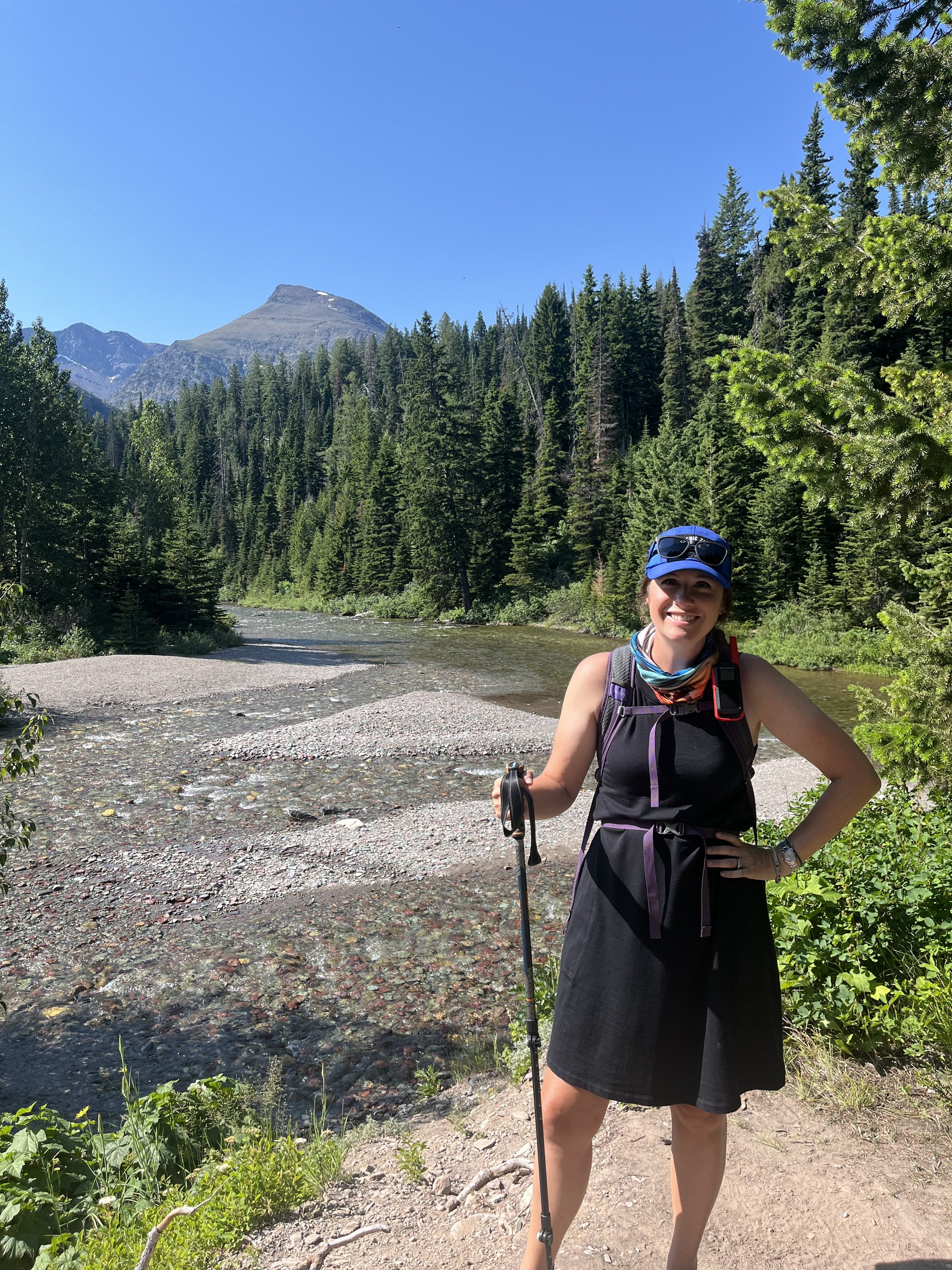
14 Best Hikes near Greenville SC for Families

Table Rock State Park near Greenville SC
Explore the beauty of the South Carolina upstate with the best hikes near Greenville SC!
In less than thirty minutes, visitors and residents of Greenville can leave the shops and restaurants of downtown behind and be surrounded by the natural beauty of the rolling foothills.
Just a little further down the road, and you'll be in the mountains with spectacular views, waterfalls, and hiking trails.
Take your family out to explore each of these naturally beautiful places near Greenville, all of which are within 90 minutes of downtown.
In the hiking guide below, you’ll find 14 suggestions on where you and your family can hit the trails, including trail highlights, parking tips, and difficulty levels.
Hiking around Greenville: An Overview
What is hiking like in Upstate South Carolina?
Greenville, South Carolina, is in the Upstate area, at the base of the Blue Ridge Mountains, which is part of the Appalachian Mountain chain that runs from Georgia to Maine.
Because of this location near the mountains, the greater Greenville area has easy access to trails of all sorts. There are more difficult, mountainous hikes in areas near the North Carolina-South Carolina state border, like the Table Rock hike, but there are plenty of easy to intermediate trails with manageable elevation.
If you’re used to hiking in places like Colorado, Wyoming, or Montana, these mountain trails will feel more like foothills since the Appalachians are so much smaller than the Rockies. Still, the rolling hills and craggy peaks outside of Greenville are absolutely gorgeous and well worth your time whether you’re a resident of the Upstate or just visiting.
What’s the weather like around Greenville?
Greenville and the Upstate have 4 distinct seasons, but it’s rarely cold enough to have a lasting snow or ice cover. This makes for excellent hiking in the fall, winter, and spring. The summers are warm and humid, but they do stay cooler than the Midlands near Columbia and the Lowcountry near Charleston.
Even in the summer, you can hike most of the time without overheating, especially if you pick a trail that’s shady throughout. This is in stark contrast to hiking in Charleston, which is rarely enjoyable between late May and late September.
Spring and fall are our favorite times to go hiking near Greenville as the temperatures are mild and the crowds are light.
Occasionally, the Greenville area will get snow, usually in January or February.
There’s a higher chance of the snow and ice sticking around if you’re hiking in the mountains themselves (such as at Caesar’s Head).
If you’d planned on hiking when winter weather is being forecast, use precautions. Keep listening for weather updates, wear layers (not cotton!), and keep in mind that many roads in this area are 2 lane backroads that are prone to icing over.
What should I bring hiking near Greenville?
Before you set out on any hike, it’s a good idea to check for any recent updates, trail conditions, and level of difficulty at AllTrails! Purchase your annual subscription here.
Few of these areas are truly remote, and most have decent cell signal. As you get further away from Greenville and into some of the more mountainous areas like Walhalla, that signal becomes less reliable.

PIN ME!
For this reason, I always carry our Garmin InReach Mini while I’m hiking with our kids as it gives me peace of mind knowing that I can get help for myself or one of them while we’re on the trail.
I also always have a hat for myself and the kids, which keeps us from getting sunburned in the summer and somewhat dry if a storm pops up. My kids often use this wide brimmed hat while we’re hiking, which is lightweight and breathable.
Many of these trails have a water component, so it’s a good idea to pack a lightweight towel or two in your day pack. My kids always seem to find a way to get in the waterfall cascade or nearby streams, so we come prepared! We’ve used these colorful Turkish towels for years now, and they’re still holding up well.
Definitely bring snacks and plenty of water.
While you’re never very far from a visitors center or small town, these hikes are just far away from a grocery store or restaurant that you’ll want to pack your own food.
Do these trails cost money?
The trails inside of many of the state parks, like Oconee State Park, Caesar’s Head State Park and Table Rock State Park, do require an entrance fee. Others, like Oconee Station State Park, are free, as are all of the others not in the state parks listed above.
NOTE: If you’re planning to visit more than 2 state parks in any 12 month period, I highly recommend getting a South Carolina state parks pass. This pass also gets you discounts on merchandise and campground reservations.
When can I go on a fall foliage hike near Greenville?
The fall foliage is a BEAUTIFUL time to go hiking in the Upstate!
It varies a bit from year to year, but usually, the first week of November is prime leap peeping time.
This is, hands down, my favorite time of year to be outside in the Upstate as the Blue Ridge Mountains explode into color.
All of the suggested hikes in this article will provide plenty of opportunity to see these beautiful colors.
Does public transportation run to these hikes?
Public transportation is available to the Swamp Rabbit Trail through Greenlink.
Check the route map for more information.
For all of the other hiking trail suggestions, you’ll need to rent a car if you don’t have a private vehicle.
When selecting a rental car in Greenville, a regular coupe or sedan will work just fine, and there’s no need for 4x4 even in the winter when visiting these trails.
The roads leading to these hikes are paved and well marked.
Explore more around Greenville!
Best Hikes near Greenville SC
Both my husband and I spent our elementary school years in the Greenville area.
Then, we both went to Clemson University, which is about 30 minutes from downtown Greenville.
We’ve spent a considerable amount of time in this area, both as kids and adults, and we love returning again and again with our own children!
One thing we love about hiking and camping in and around Greenville is the wide range of options we have: there are hikes with waterfalls, hikes with covered bridges, and hikes with amazing vistas.
So, if you’re looking for the perfect day outdoors in Greenville with your family, I have an excellent round up of hikes below.
There are simple, short hikes with little elevation for those little ones who are just getting their trail legs as well as intermediate hikes for families with older kids ready to take on more.
Frank Coggins Loop Trail
Location: Caesar’s Head State Park, 8155 Geer Highway, Cleveland, South Carolina
Distance from downtown Greenville: 53 minutes

If you’re planning a Caesar’s Head hike with little kids, I’d recommend the short, easy Frank Coggins Loop.
It’s located inside Caesar's Head State Park, which has extensive trails that wind up and down through some of the prettiest mountain areas in Greenville County.
You’ll start and end right at the visitors center, which is ideal for snack and bathroom breaks.
The entire loop is 1.8 miles, which is doable for families with small children.
Your kids will love to find the 2 waterfalls. There’s also a cave along the way that you can poke your head into!
Raven Cliff Falls Trail
Location: Caesar’s Head State Park, 8155 Geer Highway, Cleveland, South Carolina
Distance from downtown Greenville: 53 minutes
Also located in Caesar’s Head State Park, Raven Cliff Falls trail is a good choice for families with older kids or more experienced hikers.
This out and back trail covers 4.4 miles and is moderate in intensity.
The park is actually part of the larger Mountain Bridge Wilderness Area (which includes Raven Cliff and Cleveland Cliffs waterfalls), so if you get tired of Caesar's Head, there's still plenty of do within a short distance.
Give your favorite little hiker something they’ll love! Check out our list of best gifts for camping kids here.
Lakeside Trail
Location: Table Rock State Park, 158 E. Ellison Lane, Pickens, South Carolina
Distance from downtown Greenville: 43 minutes
As a kid, my parents often would bring my sister and I to Table Rock State Park for a quick getaway. We only lived 45 minutes away in Seneca, but the topography changes enough between the two areas of the Upstate that it felt like we were truly on vacation here.
Even after we moved away from the Upstate, we'd return to stay in one of their little cabins and enjoy the fresh mountain air on long weekends.
Little kids and their families will love the easy and almost completely flat Lakeside Trail, which follows the edge of the lake in the middle of the park. The trail here is wide and sandy, and it is a peaceful option for families with younger hikers.
There are several areas where you’ll have uninterrupted views of the lake, so kids can practice skipping rocks (or throwing them to hear the “ker-plunk!” if they’re like my kids!).
History buffs can see the efforts of the Civilian Conservation Corps on this trail.
The CCC were responsible for much of this park’s construction, including the Lodge and dam.

Trail over Carrick’s Creek in Table Rock State Park | source
Carrick Creek Trail
Location: Table Rock State Park, 158 E. Ellison Lane, Pickens, South Carolina
Distance from downtown Greenville: 43 minutes
Carrick Creek Trail is another great, easy option for families inside of Table Rock State Park.
This trail begins at the nature center and does a 2 mile loop around the park.
Kids can practice identifying the many types of trees in this section of the forest, and see if they can find the waterfalls scattered along the route.
This hike is largely flat and has several bridges to keep your child engaged throughout.
While it isn’t stroller friendly, it is a great beginner hike even for younger kids.
Table Rock Trail
Location: Table Rock State Park, 158 E. Ellison Lane, Pickens, South Carolina
Distance from downtown Greenville: 43 minutes
If you've got time, you can try the 7.2 mile Table Rock Trail, which promises stunning views of the Blue Ridge mountains for those dedicated enough to see the hike through.
Note, however, that the out and back Table Rock Trail is particularly strenuous for beginning and/or young hikers, and several sections require hikers to climb up steep angles.
I first did this hike in high school, and it was fairly challenging for me as I didn’t do much hiking back then.
The hardest part of this hike is getting to the pinnacle as there are no areas where you’re not ascending, and, so, there aren’t any good areas where you’re getting a break. The silver lining here is that the return trip is all downhill, so it will take no time at all to get back to your car!
If you and your child—at any age—are used to hiking in the mountains of South Carolina, than this trail might be a great day hike challenge.
Riley Moore Falls
Location: Riley Moore Falls Trail, Westminster, SC 29693
Distance from downtown Greenville: 1 hour 26 minutes

The swimming hole and falls on the Riley Moore Falls Trail
One of the must-visit places on my ultimate South Carolina waterfalls road trip, this set of small cascades is hidden away in the Sumter National Forest.
However, the trouble of finding it is well worth the quiet and relaxation you’ll find by the calming falls.
On a warm day, pack a towel and wear quick-dry shorts so you can splash about in the swimming hole at the base of the falls.
To get to Riley Moore Falls, you’ll need to navigate a forest road and then hiking in on a much smaller forest access road. The trail continues past a second, very small parking area and along a short ridge before gently sloping down to the sandy beach at the falls.
For more details on parking and access to the falls, read my hiking guide to Riley Moore Falls here.
Station Cove Falls

The Camping Kiddos at Station Cove Falls
Location: Burrells Rest Drive, Walhalla, SC 29691
Distance from downtown Greenville: 1 hour 14 minutes
Station Cove Falls Trail is one that we return to over and over again with our kids. There’s a huge payoff here for a very easy trail, making this a great choice for families with less enthusiastic little hikers.
While there is some elevation gain, the packed dirt trail is largely flat and well defined.
Along the way, you’ll wander around gentle curves in the forest and past a small stream. At the end of the trail is the base of Station Cove Falls.
While there’s no swimming hole here, the falls and stream are gentle enough to go wading on a warm day. Pack a towel because your kids will get wet as they get splashed by the falls and jump around in the stream.
If you want to extend your hike, you can jump onto a spur trail near the falls, which is the Oconee Passage of the Palmetto Trail. This will take you back to Oconee State Park!
Issaqueena Falls and Stumphouse Tunnel
Location: Stumphouse Tunnel Rd, Walhalla, SC 29691
Distance from downtown Greenville: 1 hour 14 minutes

My daughter at Issaqueena Falls
Issaqueena Falls is a beautiful hike with both an easy overlook option and a more challenging option to the base of the falls.
If you’re visiting with kids and just want a glimpse of Issaqueena Falls, there’s a short trail to the overlook area.
If you feel like getting a bit more into the hike, you can follow the sloping trail down closer to the falls.
This trail is a part of the Issaqueena passage of the Palmetto Trail, which stretches across the entire state of South Carolina.
After you’ve explored around the falls, there’s another must-do activity in this area: Stumphouse Tunnel.
It was originally an attempt at building a railroad through the mountain before the Civil War in order to connect Charleston, SC, with other railroad cities in Tennessee. However, the war started, and the company lost their workforce to the war efforts as well as all of their funding.
Years later, nearby Clemson University realized that the moist, dark and cool environment was the perfect place to store their famed bleu cheese. While you’ll have to go by the University to pick up the cheese today, the tunnel is still a great place to visit.
When I was a kid, the tunnel was open much further back than it is now, and you could go all the way to the end of the blasted area.
Today, there’s a gate up to prevent people going beyond the first section, but that will still get you far enough back into the tunnel to need a flashlight.
>> Read my full guide to visiting Issaqueena Falls and Stumphouse Tunnel here. <<
Explore more in the North and South Carolina mountains!
Old Waterwheel Trail
Location: 624 State Park Rd, Mountain Rest, SC 29664
Distance from downtown Greenville: 1 hour 31 minutes

The Camping Kiddos in the old waterwheel building
Located inside Oconee State Park (not to be confused with Oconee Station State Park), the Old Waterwheel Trail is a fun loop trail with just enough elevation gain to be challenging.
The trail descends from the parking lot down to the ruins of a building that once had a waterwheel on it.
The trail cuts through the stone building, which is covered in moss and looks like something out of a Brothers Grimm story!
From there, you’ll head back up through the forest, and you’ll complete the loop by walking the final 1/4 mile along the small paved road that runs between the Oconee State Park campground and the cabins.
NOTE: Oconee State Park has some excellent camping, both tent and RV. Check out my complete guide to Oconee State Park camping here!
Poinsett Bridge
Location: 601 Callahan Mountain Road, Travelers Rest, South Carolina
Distance from downtown Greenville: 39 minutes

Poinsett Bridge near Travelers Rest, South Carolina
Closer to Greenville (and just outside of the adorable Travelers Rest), this stone bridge has a distinct Gothic arch.
The bridge looks like one that you'd expect to find on a ramble through the English countryside, not in the middle of the woods in South Carolina!

Our daughter on the Poinsett Bridge Trail
Although the bridge is named after Joel Poinsett, a 19th century U.S. ambassador to Mexico, he had nothing to do with the building of it.
In fact, the identity of the architect responsible for it is unclear, though most believe that it was constructed by the same man who designed the Washington Monument.
Regardless of its origins, this whimsical bridge is quite photogenic, and we saw several families taking their Christmas card photos here.
The bridge was originally found along the road between Greenville, South Carolina, and Asheville, North Carolina.
The bridge is now closed to traffic, so you're free to roam around the area on the Poinsett Bridge Trail.
The trail is a 0.8 mile loop through the forest.
The entire trail is wide and cleared off, and it would make an excellent short hike for kids.
Interested in hiking as a hobby, but think it’s too expensive? Check out our guide to hiking for beginners on a budget!
Swamp Rabbit Trail
Location: various locations in Greenville County

The section of the Swamp Rabbit Trail near Travelers Rest
Stretching over 22 miles through Greenville County, this trail has been a major part of the revitalization efforts in Greenville and Travelers Rest.
It follows the now covered railroad tracks that once brought goods to this area, and is used for local races, community exercise, and more.
Hop on your bike for an afternoon ride or lace up your running shoes to practice your sprints.
The paved path is great for all sorts of activities including easy family hikes close to Falls Park.
Since there’s no true beginning or end to this trail like there are on the rest of the hikes on this list, you get to choose your own adventure here! Head out for as long as your kids are excited about hiking along it, then turn around when they start to get tired.
For that reason, this is an excellent first hiking area for kids who don’t have much experience.
Plus, it’s stroller friendly in many parts so that families with kids of all ages can get out into the fresh air.
There are plans to extend the trail even further, so you'll soon be able to see even more of the county this way!
Along the way, you’ll be able to easily access local restaurants and shops if your kids need a quick break. Travelers Rest, South Carolina, is easily accessible from part of the Swamp Rabbit Trail and offers excellent pizza, a historic hardware store, and much more.
Check out this interactive map to find a section of the Swamp Rabbit Trail closest to you.
Yellow Branch Falls
Location: 2911 Highlands Highway, Walhalla, South Carolina
Distance from downtown Greenville: 1 hour 24 minutes

Yellow Branch Falls is especially pretty in the fall!
The Yellow Branch Falls trail is one of the most popular trails near Walhalla, SC, for good reason. This beautiful trail winds through the Sumter National Forest and ends in a delicate cascade.
The 2.6 mile round trip has little elevation gain, which makes it perfect for beginning hikers and families. There are a few areas with a drop off, but the trail is wide enough to keep parents from stressing.
When you arrive at the cascades, you can watch the falls from the side, or get down next to the base of them with just a bit of rock scrambling.
Plus, the falls’ location north of Walhalla puts you in easy driving distance of Issaqueena Falls and Stumphouse Tunnel if you wanted to make a day of it in this area.
Campbell’s Covered Bridge
Location: 171 Campbell's Bridge Road, Landrum, South Carolina
Distance from downtown Greenville: 42 minutes

The cute Campbell’s Covered Bridge
Is anyone else sad that covered bridges really aren't a thing anymore?
South Carolina has exactly one left...and you're looking at it.
Thankfully, Campbell's Covered Bridge has been preserved on county property, so generations to come will be able to enjoy its quaint charms.
Its history stretches back to 1909 when it, and three other covered bridges, were built in Greenville County.
The titular Campbell was a local mill owner who gave his land for the bridge's construction.
Explore more of this area on the short 0.8 mile Campbell’s Bridge Hike, which takes you underneath the bridge and beyond.
The hike is a loop, and is easy enough for even the most inexperienced of hikers.
Rainbow Falls and Pretty Place
Location: 100 YMCA Camp Road, Cedar Mountain, NC
Distance from downtown Greenville: 1 hour 10 minutes

Pretty Place Chapel
This hike has one of the best views in the Upstate, and it allows you to get super close to a waterfall.
If you’re hiking with kids, you know that you need a big pay off on hikes.
With this one, you’ll have not one but TWO exciting points of interest.
Pretty Place, however, is situated on the side of a mountain; there are no walls or doors. When you walk in, all you can see is the stunning nature all around.
Even if you're not religious, the view is worth the drive up to the Camp Greenville property.
You can park outside the chapel, and then follow the signs to the trailhead towards Rainbow Falls.
From the parking lot at Pretty Place, the falls are about 0.75 miles on an uneven trail.
There’s not much elevation gain, but you’ll have to be careful to pick around roots and rocks.
What's your favorite way to enjoy the outdoors in Greenville County? Have you done any of these hikes near Greenville?