1 Week in Great Smoky Mountains National Park Itinerary
Spend 1 week in Great Smoky Mountains National Park with this itinerary, and see waterfalls, historic homes, incredible long range views, and more!
The most visited park in the U.S. National Parks system, Great Smoky Mountains National Park hosts millions of visitors each year.
Despite that growing number of visitors, the park rarely feels crowded thanks to its sprawling size, covering sections of both the Tennessee and North Carolina mountains.
A 7 day visit to the Great Smokies is the perfect time to make the most of out of this beautiful national park, and we’re sharing all of our favorite tips for visiting below.
Here, you’ll find everything you need to plan your next week-long Great Smoky Mountains National Park itinerary, complete with kid-friendly hiking suggestions, places to stay, and activities.

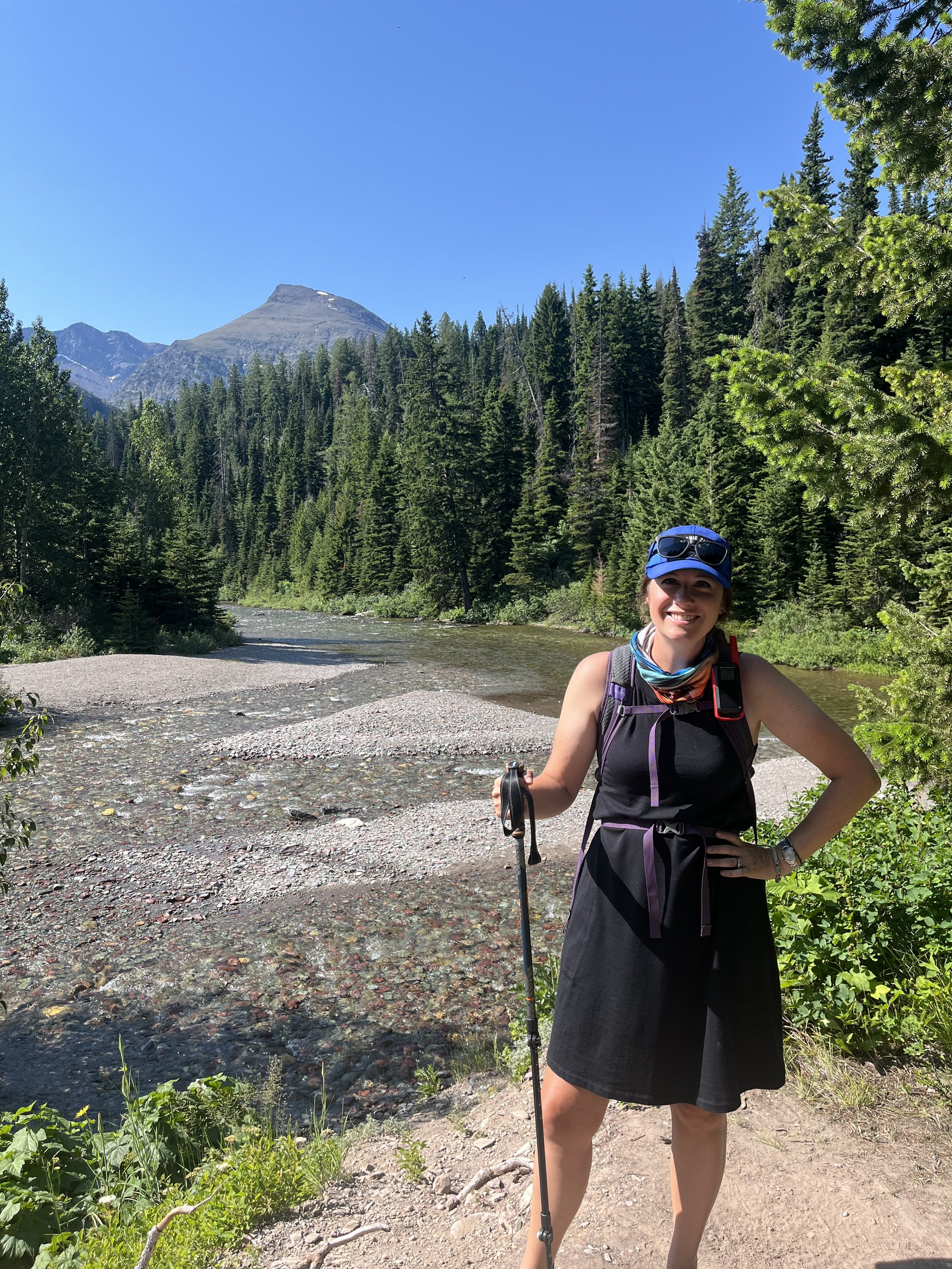
The hiking path and beautiful blue mountains near Clingman’s Dome
This post contains affiliates. If you purchase through one of the links below, I will receive a commission at no charge to you.
What to Know Before Visiting Great Smoky Mountains National Park
The park is open year round.
However, your available experiences both in and out of the park change drastically from season to season.

The Camping Kiddos at Cataract Falls near the Sugarlands Visitors Center
The national park sees the most visitors during the summer, when the weather is at its mildest, wildlife are abundant, and everything in the park is open.
You’ll be treated to incredible displays of fall foliage in late September and early October—and fewer crowds!
However, the ranger programs and visitor center hours are cut back in the fall.
Winter sees the lowest number of guests, and you’re likely to have the open trails all to yourself.
However, ice and snowstorms are always a possibility from December to February, which can close main roads.
Many roads, such as the one to Clingman’s Dome (also known as Kuwohi), closes from late fall into spring, so you’ll be missing out on some highlights of the park.
Spring is a beautiful time to visit with wildflowers and greenery popping up everywhere.
You can still see chilly temperatures—and even a random snowfall!—which makes for less than ideal camping.
Weigh your options between camping in the park versus outside of the park.
Areas near all of the park’s entrances are filled with campgrounds, so you’ll have to decide if you’re going to make use of those—and drive into each section of the park—or stay at one of the more primitive park campgrounds.
The national park hosts 10 campgrounds within the border of Great Smoky Mountains, but not all are open year round.
Additionally, 9 of the 10 park campgrounds do not have shower or restroom facilities, so you’ll have to camp in a self-contained trailer (or otherwise get creative with your daily washing!).
All of the park campgrounds do have drinking water, and many have some sort of toilet facilities.
One of the park’s campgrounds—Look Rock Campground in the west—does offer 10 RV sites with electric and water hookups.
If your family would rather have full hookups and access to shower facilities, there are many options within easy driving distance.
I’ve noted the closest park campground and a recommended campground outside of the park for each day on the itinerary below.
The national park is big.
Great Smoky Mountains National Park covers just over half a million square miles, which is daunting for a first time visitor. This puts it at about half the size of the Everglades, and about a quarter of the size of Yellowstone National Park.
Adding in the fact that there are multiple entrances across 2 states, and you’ve got a situation where you can run yourself silly trying to see everything.
In the itinerary below, I’ve done my best to include the park’s highlights and iconic sites while also being reasonable in the amount of driving that most people want to do on a vacation.
You won’t be able to see everything, but that gives you a great excuse to come back for a second (or third) visit.
TIP: As you explore Great Smoky Mountains National Park, I highly recommend using the national park’s GuideAlong audio tour as you drive!
These tours are inexpensive but excellent, and they start and stop automatically as you reach points of interest. You’ll come away with a better understanding of the park’s famous people, wildlife, history, and geology.
You’ve got limited food options in the park.
While the Great Smoky Mountains National Park is surrounded by cute mountain towns, the layout of the park means that you can be more than an hour away from the closest entrance at any given time.
You certainly don’t want to burn up your time in the park going back and forth for lunch, so stock up on groceries when you first arrive.
This approach will allow you to pack food and snacks each day, which you can then eat in one of the picnic areas or in a tailgate-style picnic.
Map Overview of your Great Smoky Mountains National Park Itinerary
If you’re a visual learner like I am, you’ll want to see a bird’s-eye overview of the entire itinerary.
Below, I’ve included major points of interest and trailheads that are mentioned in the day-by-day itinerary below to help you better organize your vacation plans.
Great Smoky Mountains National Park 1 Week Itinerary
Day 1: Arrival and Sugarlands Area
Arrive in the Pigeon Forge/Gatlinburg area.
I will note that if you’ve never been to this part of Tennessee before, you might want to add in a day at the beginning or end of your trip just so you can experience Pigeon Forge.
It’s not everyone’s cup of tea as there’s more here to do than you could accomplish in a lifetime, but if you like kitschy fun in the way of go kart racing, shopping, mystery theatre, and pancake houses, you’ll want a day here.
I will note that the Titanic Experience museum here is excellent and extremely well done, and it comes recommended for history buffs passing through.
First time visitor? Check out my guide to the national parks for beginners here!
If you’d rather dive right into the beautiful natural surroundings instead, you can park at the southwestern corner of Gatlinburg and hike into the closest park entrance sign and Sugarlands Visitors Center via the Gatlinburg Trail.

The Camping Kiddos and parents at the park sign along the Gatlinburg Trail
I was astounded at how quickly the hustle and bustle of Gatlinburg disappeared on the trail. It’s the perfect transition into your Great Smoky Mountains vacation!
On this first day, I recommend stopping by the Sugarlands Visitors Center to pick up a map, talk to the rangers, and get an overview of the park.
The Sugarlands Visitors Center is the biggest—and most visited—in the park, so plan to spend a bit of time there exploring.
There is a small museum onsite, which explains the history of the park. It’s free and located behind the main ranger counter.
This is a great time to pick up a Junior Ranger booklet for the young (and young at heart) in your party. The booklets are a couple of dollars and come with a little pencil.
NOTE: Great Smoky Mountains National Park is one of the few places we’ve discovered that charge for their Junior Ranger booklets, which are usually free. This is likely to keep the program to those people who plan on completing it, and to cut down on waste in the park.
The Sugarlands Visitor Center is also where you can pick up your booklet for the Hike the Smokies for Families booklet. There is a small fee for this booklet.
In it, you can record the number of miles that your family hikes in the park. Goals include 10, 25, 40, and 50 miles on a local trail, and you’ll get a pin for each milestone!
TIP: It’s always helpful to get up-to-the minute notes on hiking trails, so I recommend scoping out the trails at Great Smoky Mountains National Park on AllTrails+ before you go.
For an easy hike on your first day in the park, head behind the Sugarlands Visitors Center for the trail to Cataract Falls.
The majority of the path is paved, but there are several sections with rocks and roots. Still, it’s flat enough for even younger kids to walk it.
The hike to Cataract Falls is about 0.7 miles one way, and you’ll be rewarded with a 40-foot waterfall at the end!
>> Explore our complete trail guide to Cataract Falls here. <<
If you have additional time on your first day, I recommend completing the Roaring Fork Motor Nature Trail.
This loop carries visitors through an easily accessible section of the park near Gatlinburg, and there are multiple areas to stop off and hike or picnic.
Grotto Falls is one of those stops that you must include. The trail is an out-and-back 2.6 mile round trip. You’ll be rewarded for your hard work with a pretty waterfall that you can walk behind.
Once you’ve completed the Motor Nature Trail, it’s time to set up camp.
Nearest park campground: Elkmont Campground (6 miles from Sugarlands Visitors Center)
Suggested private campground: Twin Creek RV Resort, Gatlinburg, TN
Add more adventure to your national parks itinerary with these activities:
Day 2: Sugarlands Area
We’re continuing our explorations on the Gatlinburg side of the park today with some of the best long range views in the area.
Whenever you’re up and moving, head down New Found Gap Road to Clingman’s Dome Road. This side road will climb more than a 1000 feet as you ascend to the highest point in the park.

The long range views from the Clingman’s Dome observatory are incredible!
To truly get to the uppermost point, you’ll need to park and walk the short but incredibly steep trail to the observation tower.
For more information, check out my Clingman’s Dome hiking guide here.
There’s another visitors center at Clingman’s Dome, but it’s much smaller than the one at Sugarlands. Still, you can pick up a Junior Ranger booklet here if you didn’t already.
If you like the occasional roadside oddity as much as I do, I’d also suggest stopping to see the hidden tunnel on Clingman’s Dome Road.
Once a part of a CCC trail, this area is now defunct, but still accessible to the public.
Your next stop is at the intersection of Clingman’s Dome Road and Newfound Gap Road. Park in the dedicated parking lot for Newfound Gap and have a quick picnic tailgate.
[NOTE: If you want to sit down at an actual picnic table, there are several at the Chimney Picnic Area, just a few miles up Newfound Gap Road towards Gatlinburg. There’s also a short 1/4-mile nature trail at the picnic area, too.]
From the parking lot, you can access the Appalachian Trail, a portion of which runs through the national park.
Hop onto the AT going away from Clingman’s Dome. If you follow it for about 4 miles (one way), you’ll encounter Charlie’s Bunion, one of the best overlooks on this part of the Appalachian Trail.
Even if you don’t want to hike the entire way to Charlie’s Bunion, this is a beautiful section of trail.

Part of the Alum Cave Trail | source
If you have the time (and inclination) to squeeze in one more hike in this part of the park, the Alum Cave Trail is a great option.
If you take this trail to its end, you’ll go to Mount Le Conte, 10 miles away. However, there are multiple areas along the way that make for shorter—but no less enjoyable—hikes.
1.4 miles into Alum Cave Trail is Arch Rock. Go a bit further (2.5 miles from the trailhead) is a large rock outcropping called the Alum Cave Bluffs.
Head back to your campsite or into Gatlinburg for dinner and to rest up for your next day’s park adventures. Stop by the Ben Morton Overlook on your way out of the park to catch an incredible sunset!
Nearest park campground: Elkmont Campground (6 miles from Sugarlands Visitors Center)
Suggested private campground: Twin Creek RV Resort, Gatlinburg, TN
Day 3: Gatlinburg to Oconoluftee
Today, we’re moving further south into the North Carolina portion of the park. The area around Oconoluftee Visitors Center provides additional hiking and several areas to learn more about the park’s history.
As with much of the park, the journey is as good as the destination, and I’ve suggested several overlooks and quick hikes along the way.

Newfound Gap Road is the easiest way to cut through the park north-south, but it’s also a gorgeous drive.
In the morning, head south on Newfound Gap Road. Your first stop is at the Deep Creek trailhead, just south of the Newfound Gap parking lot.
There are several trails that start in this area, but we’re interested in the 2 shorter ones: Juney Whank Falls and the Three Waterfalls Loop. (See a great map of the Deep Creek area here.)
If you’re traveling with little kids, Juney Whank Falls trail is a great option at only 0.6 miles round trip. Kids will enjoy the pretty bridge and 2 sections of the waterfall.
The Three Waterfalls Loop also starts at Juney Whank Falls, but continues onto Indian Creek Trail to the Indian Creek Falls.
The final falls on the loop is Tom Branch Falls. All three are easy to access via the roughly 2 mile loop (though you can extend with one of the many other trails in the area.)
There’s a small pool at the foot of Indian Creek Trail, which is quite refreshing on a hot day!
A little less than a mile down the Newfound Gap Trail is the beautiful Charles A. Webb Overlook. It’s a great place to stop for photos of the NC mountains.
Around Mile Marker 24, you’ll see the roadside Cliff Branch Falls. If you need to stretch your legs, this is a good place to do so, though you’ll be able to see the falls from your car at the northern end of the pullout area.
Stop at the Collins Creek Picnic Area near MM 25, where you’ll find several shaded picnic tables and plenty of parking.

Mingus Mill in the Smokemont area of the park | source
After lunch, head another mile and a half to Smokemont, where you can take a horseback ride into the mountains. The Smokemont Riding Stables offers up excursions ranging from 1-4 hours.
There are wagon rides for anyone who doesn’t love horseback riding or is too young for the horse excursions.
If you’re looking for something to eat or somewhere to pick up groceries, head into nearby Cherokee, NC, which is one of the best towns near the Great Smoky Mountains National Park.
The Oconoluftee entrance to the park is less than 2 miles from Smokemont. From the Oconoluftee entrance, Cherokee is an easy 10 minute drive.
Nearest park campground: Smokemont Campground
Suggested private campground: Cherokee KOA
Day 4: Oconoluftee Area

PIN ME!
Your time in the Great Smokies is halfway done, but we’ve still got plenty of adventuring to do!
Today, you’ll spend the entire day in the Oconoluftee area, where you’ll see additional examples of what this area looked like before it was the park, and you’ll get to cruise on some of the most scenic stretches of road on the North Carolina side of the park.
First, stop by the Mountain Farm Museum, which is located next to the Oconoluftee Visitors Center. Here, you can learn about the day-to-day lives of the farmers who eked out a living among these intimidating mountains.
There’s a barn, homeplace, and out buildings to explore. The site is open year round, but there are living history demonstrations during the warmer months, which helps to further visually what life was like here in the late 1800s.
From there, embark on a beautiful loop drive, starting with the Blue Ridge Parkway, heading around to Heintooga Ridge Road, then following Straight Fork Road and Big Cove Road. You’ll end up on Newfound Gap Road just a few miles above where you started.
The section of Blue Ridge Parkway that you’ll be driving starts just below the Oconoluftee Visitors Center and it is well marked. You’ll see the sign for the Blue Ridge Parkway to the your left about 1000 feet after you leave the Mountain Farm Museum.
There are several overlooks along this stretch of the parkway, so pick a few that you find interesting. You’ll also encounter a couple of mountain tunnels, including Sherrill Cove Tunnel and Rattlesnake Mountain Tunnel.
Travel along the Blue Ridge Parkway until you reach MM459, then look for the left hand turn onto Heintooga Spur Road.
Once you’re on Balsam Mountain Road, there are 2 excellent overlooks: Maggie Valley Overlook and Lake Junaluska Overlook. From here, you can see way down into the valley below.
Balsam Mountain Road has 2 lanes, and this is where you’ll want to turn around if you have limited time and can’t complete the entirety of the suggested scenic loop.

A bridge over a mountain stream on Heintooga Ridge Road
From the trailhead to Flat Creek Trail, Heintooga Ridge Road is one-way, and you’ve committed to the rest of the 14-mile loop.
If you’d like to stretch your legs at this point, Flat Creek Trail is a well marked 5.1 out-and-back trail through the forest. You’ll encounter a few streams along the way in addition to some old homesteads.
Around MM5 of the scenic loop, you’ll see signs for Balsam Mountain campground. Head just past that to the Balsam Mountain Nature Trail, which is only 1.2 miles round trip, and great for little kids.
Stop for lunch at the Heintooga Picnic Area, and then marvel at the views from the Heintooga Overlook beside it.
As you continue onto the road, you’ll likely see few other cars or hikers. This makes for some great wildlife spotting, so keep your camera at the ready! You might spot a mama bear and cubs or white tailed deer.
There are a couple of trailheads along the way, but most are difficult for families looking for quick hikes.
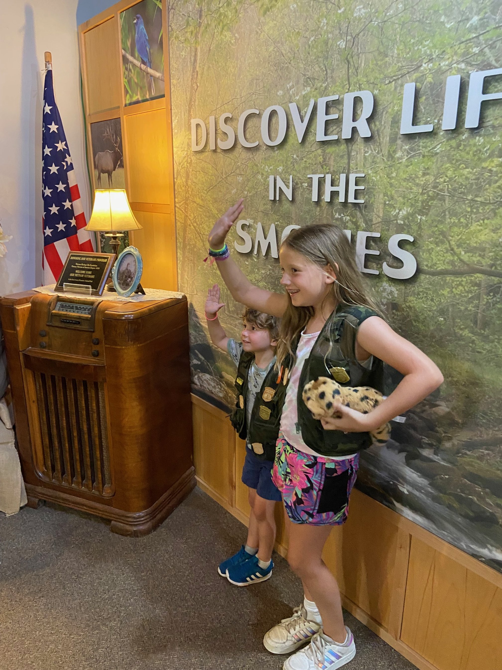
The Camping Kiddos get sworn in as Junior Rangers at Great Smoky Mountains NP.
At the end of Heintooga Ridge Road, you’ll then take the 2-lane Big Cove Road, which will wind down the mountain. You’ll take Tsali Boulevard in Cherokee back north to re-enter the park.
If you’d like to add one more adventure to your day, Mingo Falls in Cherokee is a great, easy choice. From Big Cove Road, turn over the Raven Fork river and park in the area across the river. From here, the Mingo Falls trailhead is at the back of the parking lot.
There are a series of stairs leading to the waterfall overlook, so it’s not good for strollers. But that makes the way down much easier that the way up!
Finish the day at the Oconoluftee Visitors Center, where you can shop for souvenirs and submit any completed Junior Ranger booklets.
NOTE: the Heintooga Ridge Road is closed in winter.
Nearest park campground: Smokemont Campground
Suggested private campground: Cherokee KOA
Day 5: Oconoluftee to Cades Cove
We’re heading back to the Tennessee side of the park to one of the most photographed areas in the Great Smokies!
Picturesque Cades Cove is about a 2 hour drive from the Oconoluftee visitors center, but, again, we’re looking at the journey more than the destination today.
You’ll be crossing the park heading northwest, and long the way, you’ll want to stop at several historic sites and trailheads.
For the first half of your journey, you’ll be retracing your steps on Newfound Gap Road. If there were any hikes or overlooks that you didn’t get to see earlier in the trip, now’s the time to stop.
A trail on this section of Newfound Gap Road that we didn’t have time for on the way down to the NC side of the park is Balsam Point Quiet Walkway Trail. The trailhead is just past the Chimneys Picnic Area as you drive towards Cades Cove.
The designated “quiet walkway” trail is one that puts the emphasis on small experiences in the forest instead of achieving a specific mileage on the trail. Smell, look, and touch your way down this well-marked, easy trail that loops down to the West Prong Little Pigeon River.
At only 0.25 miles long, this trail is perfect for letting little hikers stretch their legs, while also encouraging them to appreciate their surroundings.
Another excellent hike for kids in this section of the park is the Sugarland Valley Nature Trail which is a beautiful little trail with streams to jump over and wide, flat paths.
You’ll also see some old chimneys left over from the settlers who once called this place home.
The Sugarland Valley Nature trailhead is just below the Sugarlands Visitors Center, and about 0.5 mile past the Husky Gap trailhead.

Laurel Falls in summertime | source
Once you arrive at the visitors center, make a left turn onto Fighting Creek Gap Road. About 2.5 miles onto this road, you’ll see the parking lot for Laurel Falls on your right.
This popular trail is less than 3 miles round trip (out-and-back), and takes you to the base of Laurel Falls. While the path isn’t smooth—you’ll find sections with roots, rocks, and inclines—it’s easy enough that most kids will be able to traverse it without any issues.
The old building at the end of the Little Greenbrier School trail | source
Stop at the Metcalf Bottoms Picnic Pavilion for a quick picnic lunch.
If you need to walk a bit before you get back in the car, there is a short trail out to the historic Little Greenbrier School that is accessible from the picnic pavilion. This trail also runs right next to the Little Briar Branch of the Little River, and kids can splash in the shallow water.
Then, continue onto the overlook area for Meigs Falls. You can see this waterfall from the road, but there’s also a short, easily accessible path if you’d like to get closer. Parking can be a bit tough here at peak times.
From here, head to your campground to settle in for the day. If you have time and energy afterwards, I’d suggest visiting the Great Smoky Mountains Heritage Center in Townsend, which is less than 2 miles from the Townsend entrance.
Nearest park campground: Cades Cove Campground, at start of scenic loop road
Suggested private campground: Townsend/Great Smokies KOA Holiday
Day 6: Cades Cove
On your final full day in the park, we’re heading into Cades Cove, which is best known for its 14-mile scenic loop road.

The 1-way road that carries visitors through Cades Cove
You’ll enter the scenic loop off of Laurel Creek Road, and it’s well marked.
If you happen to be visiting on Wednesdays, the loop is closed to car traffic, and I highly recommend that you rent a bicycle to tour this area of the park this way.
If you didn’t bring your own bikes, you’ll find a variety for rental at the Cades Cove Campground Store and Bike Rental. This store is near the start of the scenic loop where the road is still 2-way.
In this same area near the store, you’ll also find a visitor and interpretive center, as well as a stable if you’d prefer to ride through this section of the park.
The road is 1-way and runs counterclockwise, beginning and ending near the Cades Cove campground.
Towards the beginning of the loop is the Rich Mountain Loop trailhead, which will take you to the Crooked Arm Cascades. When you’re on the trail, cross the Crooked Arm Branch of Abrams Creek, and then take the trail to the right when it forks. The falls are a couple hundred feet down the trail spur.
It’s an easy trail at about 2 miles round trip.

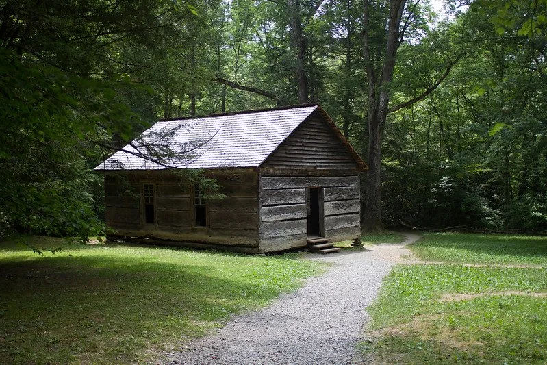
If you’re enjoying seeing the historic homes and buildings in Great Smoky Mountains National Park, the John Oliver Cabin is down a short trail off of Cades Cove Drive, about 0.5 miles after the trailhead to Rich Mountain Loop/ Crooked Arm Cascades.
There are several churches just off of the road past the John Oliver Cabin trailhead.
You’ll come to the Cades Cove Visitors Center, where there are several other historic buildings, including the drive-through barn! The design created air flow in the hot barn, but it is quite unusual looking.
Stop here to see the buildings, ask questions of the rangers, and use the restroom.
On the second half of the scenic drive, you’ll be able to see additional historic homes and a cemetery before returning to the start of the loop.
Grab lunch in Townsend before heading to your final big outing near the park: the Tuckaleechee Caverns.
While the caverns are technically outside of the park boundaries, the experience here is unlike anything you’ll find in the park. Plus, exploring the cave system here is a fascinating glimpse into what’s going on under your feet in many places throughout the national park.
Highlights of the 1.25 mile guided walking tour include the 200 ft. underground waterfall and the most sensitive seismic station anywhere on earth.
From March to November, the caves run tours every day; in December, January, and February, the caves are closed to visitors.
Nearest park campground: Cades Cove Campground, at start of scenic loop road
Suggested private campground: Townsend/Great Smokies KOA Holiday
Day 7: Back to Gatlinburg and Depart
It’s time to head back to Gatlinburg for whatever adventures await you next!
Depending on much time you have today before you have to catch a plane or get on the road, you could add in a short hike or two between Cades Cove and Gatlinburg.
You’ll take Laurel Creek Road until it intersects with the Parkway, which will take you directly into Gatlinburg.
The Meadow Branch Cascade trail is short and easy with parking right off of Laurel Creek Road.
The Townsend Wye area near the Townsend entrance is the perfect place for a picnic lunch or to let your kids go wading in the stream.
I hope you’ve enjoyed your week in the Great Smoky Mountains National Park, and that you come back to this beautiful area of the South soon!