Donut Falls Hike in Salt Lake City, Utah: A Guide

Donut Falls awaits at the end of this fun, easy trail!
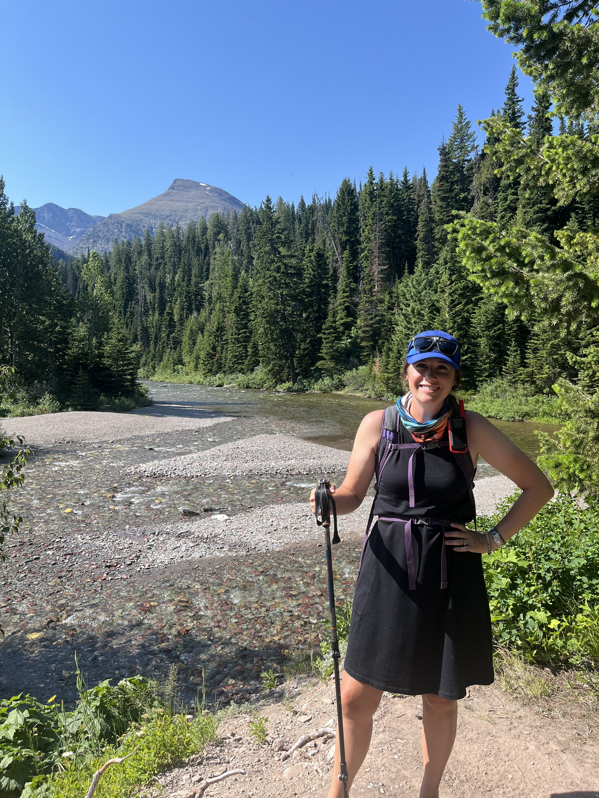
Donut Falls, located near Salt Lake City, Utah, is the perfect hike for families or anyone looking for an easy, fun outdoor adventure.
One of the most popular hikes in Big Cottonwood Canyon, this trail has 2 trailheads so you can pick how much you’d like to be challenged.
Either way, you’ll end up at the beautiful waterfall, so named because the top of the cascade disappears inside a donut-shaped hole in the rock before reappearing to form a rushing, sparkling creek.
Overall, this hike is a great one for those looking for a few hours outside near Salt Lake City, as its location, short length, and big pay-off make Donut Falls memorable.
In the guide below, you’ll find everything that you need to make your day out on the Donut Falls trail a great one, from parking tips to what you’ll find step-by-step along the hike.
This post contains affiliates. If you purchase through the links below, I will receive a commission at no charge to you.
Hike Overview
Trailhead Location: In Big Cottonwood Canyon, part of the Uinta-Wasatch-Cache National Forest southeast of Salt Lake City, Utah
Trail length: up to 3.3 miles round trip, depending on which trailhead and parking area you start from
Trail difficulty: easy
Elevation gain: approximately 200 feet
Starting the Hike: Parking and Trail Information
There are several decisions you’ll have to make along the Donut Falls hike, but the first will need to happen while you’re still in your car!
There are two parking areas for this trail:
the upper parking area located along Forest Road 19, and
the lower parking area located along Big Cottonwood Canyon Road.
The upper parking area is very small with room for only a couple of dozen cars.
I would not recommend bringing oversized vehicles or anything but the tiniest of Class B trailers down here.

The national forest ranger busy writing tickets for cars not parked in the correct areas near the second trailhead
We took our Ford F-150 when the parking area was packed, and it still felt like we were going to run into every single one of the other cars as we maneuvered in the area.
The rangers here are very specific about where you can park and where you can’t along the forest road, and you will get ticketed.
We saw many cars in this area with parking citations on their wind shields and a ranger rapidly writing more.
So, if you’re unable to find a parking spot in the 2 dedicated small lots here, don’t attempt to park in the turnaround area or along the forest road.
If the upper parking area is full—and it will be if you’re visiting on a weekend in the spring or summer—you’ve got one other choice back on Big Cottonwood Canyon Road.
In an effort to keep people from parking on the forest road, the National Forest staff has added 3 separate paved parking areas near the lower trailhead for Donut Falls.
These parking areas are also utilized by hikers setting out on the nearby Mill D North Fork trail and the Cardiff Trail.

One of the 3 parking areas off of Big Cottonwood Canyon at the Donut Falls trailhead
If you’re driving an oversized vehicle or a smaller travel trailer (i.e. a teardrop style), Class B, or Class C RV, you should be able to squeeze in somewhere in the paved lower parking.
I would not recommend bringing a Class A or anything but the smallest of travel trailers here. Even our truck and 22’ travel trailer would’ve made it very, very challenging to find a place to park.
Even at peak times, these lower parking areas don’t fill up like the upper area does, so I would aim for this (and not even bother with the upper parking) if you are visiting on a Saturday between May and September.
Or, if you just want a longer hike to Donut Falls, this is where you should park!
How long does it take to hike Donut Falls?

PIN ME!
At a normal pace (without kids in tow), you can knock out this hike in 45-60 minutes.
I had my kids along for the hike, and there were the usual number of snack breaks, stops to check the time, and dancing on the trail, so we spent about 2 hours here.
That also included time for them to throw sticks in the river and splash around near the falls.
From the lower parking lot on Big Cottonwood Canyon Road, the Donut Falls hike is about 1.5 miles round trip.
It’s roughly half of that if you manage to nab a spot in the upper parking area.
I think that the hike from the lower parking lot up to the second trailhead near the upper parking area is beautiful and far less traveled than the second half of the trail. If you have the time and motivation, I’d recommend starting at the lower parking lot trailhead.
NOTE: The upper parking area is only open for vehicle traffic in the summer as much of the forest road leading to it is impassable in the winter.
Is this hike good for kids?

My 7 year old makes his way towards the second trailhead
Yes! It is a very family friendly hike.
While there is a little bit of elevation gain, it is nearly all a gentle slope up from the 2 parking areas.
The tricky areas for little ones include the tree bridge over the Mill D South Fork River (put up as a temporary crossing when the usually wooden bridge is washed out) and the tiny rappel down from the trail into the river very near the falls.
I did this hike with my 7- and 10-year old children, and they both did just fine. My 7-year-old is the more cautious of the two, and he managed to rappel down with encouragement and deliberation!
My dad and I had to assist him over the temporary tree bridge since he was worried about the rushing water and unsteady logs.
Even with both of those potentially sticky areas, I feel comfortable recommending this trail to families with kids of all ages. If you’ve got toddlers or preschoolers, it might be a good idea to bring a carrier just to help with general tiredness and those couple of more challenging spots.
Donut Falls Trail Guide
Starting at Big Cottonwood Canyon Road

Vault toilet near the lower trailhead for Donut Falls
In order to provide an overview of the entire trail, and not just the more popular second half, this guide will start at Big Cottonwood Canyon Road near the lower parking area.
Before you head out onto the trail, consider using one of the vault toilets that are next to the trailhead.
There are 2 toilets here, each of which seems to be kept in good condition.
There is one other toilet closer to the falls, but, when you’re traveling with kids like I do, it’s always a good idea to try!
Once you head past the vault toilets here, you’ll jump onto the trailhead, which meanders over the Mill D River via a series of boardwalks.
The trail is open year round, but, if you visit in late May into June, you will be treated to the many gorgeous wildflowers that pop up along the trail.


After the end of the boardwalk section, you’ll notice the first of the elevation gain. It’s very gentle here and should be manageable by just about any hiker at any level.
The trail will turn back to the right and you’ll come out of the forest onto a small forest road. If you were to turn left and walk along that road, you’d come to the Jordan Pines Campground.
But we’re not here to see the campground, so we’ll cross the road to continue on the trail.

My son fights off a vicious Bigfoot on the trail (that looks mysteriously like his Papa!)
In this next section, the trail’s elevation gain becomes a little more obvious, though it’s never truly challenging.
We saw many hikers at all different levels of ages, physical fitness, and motivation, and while some were ascending more slowly than others, they all made it to the second trailhead!
At points between the Jordan Pines Campground Road and the second trailhead, you’ll be able to look down through the trees onto the campers below you. (The campground is closed in the winter, but it is quite lively during the warmer months.)
The forest is lush here and absolutely beautiful.
My kids were convinced that it was where Bigfoot lives and spent this stretch pretending to be mock-scared about running into one!
You’ll know you’re getting close to the second trailhead when you begin to see the Forest Road down below the trail to the right.
Just a few hundred feet after this point, the trail will curve back to the right and you’ll pop out next to the second toilet on the trail and the second trailhead.
Starting at the Upper Parking Lot

We’re at the second trailhead! (That’s the vault toilet in the small building.)
If you’re lucky enough to nab a spot at the upper parking lot, you’ll start your hike here, joining those people already on the trail from the lower parking area.
This is where the trail gets very busy as there is a marked increase in the number of people who hike the second half of this trail.
This toilet at the second trailhead is also a vault toilet, so if you were waiting for a regular one, you’ll have to keep on waiting.
At the second trailhead, you can either go to the left and follow the normal Donut Falls Trail.
Or, if the river is very high and/or the bridge has been wiped out, you’ll need to head to the left and get onto an extension of Forest Road 19.
Both reconnect before you get to the final stretch before the falls, and essentially follow different, parallel sides of the river.
In terms of scenery, the normal way might be slightly more picturesque, but we’ve enjoyed our time hiking on both sides.
I’m going to cover both ways, but let’s start with the normal one.
Normal Trail from Second Trailhead

There are gorgeous meadows surrounded by forested mountains throughout the second half of the trail.
The regular way to get to Donut Falls is to the left of the vault toilet, down a packed dirt trail that takes you quickly into the forest.
The trail will swing to the right, and you’ll be able to hear the river very well.
You’ll continue to follow along the river, keeping it on your right.
The trail is gravel and packed dirt. It’s also very wide through this section, making it nearly impossible to lose.
About a third of a mile after the second trailhead, you’ll come to the bridge.
This wooden bridge makes it easy to cross the Mill D River, which runs rapidly in the spring and summer as the snow in the mountains above melts.
From time to time, this bridge gets washed out or needs repair, and the forest service lays down a series of logs to help hikers across until the regular bridge is repaired.

If you’re here when the logs are across the river, be aware that they do bend and wiggle if more than one person is trying to walk across at the same time.
There won’t be a rail or anything to help you keep your balance, so only attempt this if you’re positive you won’t fall into the river a few feet below.
We noticed that many people turned back rather than crossing the log bridge; most of these people didn’t attempt the hike via the forest road alternative.
Just know that there IS an alternative, and don’t give up on the hike if you’re intimidated by the temporary bridge.
If you’re not interested in crossing the log bridge if the regular bridge is out or being repaired, you’ll want to use the forest road alternative (see below).
Once you’re on the far side of the river, you’re almost to the waterfall!
Continue on the trail, which has now joined the forest road, as you follow the river until you get to the small rappel.
Forest Road Alternative from Second Trailhead
If there’s something wrong with the little foot bridge (either being flooded out due to spring snow melt, washed out or under repair), you’ll see signs posted in several places, including by the vault toilet and next to the trail.
In that case, you will want to take the alternative route, which doesn’t add any discernible time or distance to the overall hike.
Essentially, you’re hiking on the right side of the river for about 1/3 of a mile instead of on the left side of the river where the normal trail is. The 2 trails parallel one another and intersect just beyond where the foot bridge is.
To get onto the alternative route, you’ll want to cross in front of the vault toilet and follow the forest road until it comes to the “turnaround” area in the upper parking area.


From there, you’ll turn back to the right, crossing the river on a vehicle bridge in the process, and follow the forest road up a slight incline. There will be a bar across the road so that vehicles cannot come this way, but there’s plenty of room for foot traffic on the far left side of the barrier.

My son really, really wanted to get into the river here, but we convinced him to hold off.
The crushed gravel forest road will turn back to the left quickly and slowly ascend as you make your way along the right bank of the Mill D River.
You’ll see and hear the river nearly the entire time you’re on the forest road, and, at points, you’ll be able to look across the stream and see the normal trail on the other side.
As you approach the intersection with the normal trail, the river flows close enough to the forest road that you can easily stick your foot in it.
If you’re visiting while the snow melt is coming down from the mountain in earnest, know that the water is moving very swiftly.
While the river isn’t wide or deep, the swiftness of the water can catch young kids off guard; this area isn’t the best place for kids to wade or splash. (There’s a much better place upstream for this.)
Within a few hundred feet from this part of the forest road, you’ll see the branch of the normal trail as it joins the forest road.
Last Stretch and Arrival at the Falls
From the point where the normal and alternative routes come together, the trail follows the forest road briefly before splitting once again.
The trail is clearly signposted to the left, while the forest road continues off to the right.
At this point, you are very close to the end of the hike. Follow the packed dirt trail as it curves back to the left. When the trail becomes rocky (and you likely see people sitting around on the larger rocks), you’re about to start the small rappel.
The trail essentially drops off at a short cliff, and it’s up to the hiker to determine how to navigate it.
While some adventurous souls manage to scramble up and down the rocks without any assistance, there is a permanent rope anchored at the top of the small drop to help those who need more support.


My kids, especially my younger child, found the rope very helpful, and my dad and I also used it for a bit of balance.
Going down was much more intimidating to the kids than when we ascended back to the trail.

You’re almost there! Donut Falls is just around that corner.
This seemed to be the case for just about everyone at this point in the trail, and everyone was patient and encouraging to one another.
Once you’re on the other end of the rope, you’ll be in the river bed.
NOTE: there’s no way to finish this hike without getting your feet wet, so you have 3 options: 1) stop at the top of the little cliff, 2) wear hiking sandals, or 3) have waterproofing on your hiking boots.

My dad, my kids, and I at Donut Falls
The water is snow melt, so it’s very clear and very cold!
We hopped from little sand bar to sand bar until we couldn’t anymore, and then committed to just getting our feet wet.
All of us were wearing hiking sandals, specifically the Keen Newport H2 sandals, which have both a protective closed toe and gaps in the side for water to flow through easily.
You’ll be able to see the waterfall as you as you make the final turn in the riverbed, just past where you come off of the little cliff.
The water flowing into the stone “donut” is easy to see from the base of the falls. This is where the trail officially ends, and you’ll need to retrace your steps to return to either the upper or lower parking area.
NOTE: Some people will try to climb up the side of the waterfall to enter the cave where the water enters the “donut.” This area is extremely slippery and can be covered in tree trunks, and is over all very dangerous.
You’ll see signs in multiple places at the base of the falls discouraging people from going any further.
More outdoor family adventures in Utah:
What to Bring to Donut Falls Trail
The Donut Falls trail isn’t nearly as remote as some of the hikes we’ve done where the closest food or water is hours away. Still, the closest part of Salt Lake City (Cottonwood Heights) and the associated stores and restaurants is about 10 miles from the lower trailhead.
We made a day out of time exploring Big Cottonwood Canyon, packing a picnic to eat at the Storm Mountain Picnic Area 6 miles from the trailhead.
Even for a short hike, there are several things to bring to make sure you have a great time.
Water
I don’t care if I’m just going on a quarter-mile nature trail: I’m bringing water with me.
If I don’t, that’s the one time when everyone in my family is dying of thirst and also forgot their water bottles.
Whenever I’m hiking, I’ve usually got my Osprey Daylight day pack on, which makes it easy to pop my water bladder in alongside my keys and other necessities.
There aren’t water bottle fill stations on the trail, so you need to bring everything you think you’ll need.
Snacks
Trail snacks make for happy hikers!
We rarely go on a hike without at least a few snacks, which are motivating when my kids get bored, and are a great way to perk up anyone who’d feeling a little droopy.
We pack a wide variety of options from the traditional trail mix and granola bars to more unorthodox picks like gummy bears, small cans of Pringles, or little clementines.
Just remember to pack out anything that you bring in (including fruit peels).
Hiking Shoes
There are several types of terrain on this trail from the boardwalks to gravel sections, and your typical pair of tennis shoes aren’t going to be up to the challenge.
I highly recommend wearing hiking shoes that can deal with this, and also get wet.
We hiked here in the early summer, so our Keen Newport hiking sandals were great. If you’re doing this late enough in the season that the river is still running but it’s also too cold to wear hiking sandals, opt for highly waterproofed hiking boots.
Final Thoughts on This Trail

You can’t take a bad photo on the Donut Falls trail since it is beautiful around every corner.
Donut Falls Trail was one of our highlights while exploring Salt Lake City!
My kids enjoyed the wildflowers everywhere, the picturesque river that runs by the trail for nearly the entire duration, and the unique waterfall as the hike pay-off.
The hike is just challenging enough to be interesting, but it’s still easy enough that kids will be able to handle it with some guidance.
Other than the parking woes (which can be stressful), this hike is an excellent way to experience the beauty of the Wasatch Mountains and the Uinta-Wasatch-Cache National Forest with just a short drive to a major metropolitan area.